The Multi-Hazard Early Warning System Design & Implementation Center (MHEWC) is envisioned as a global platform for research, design, development, and implementation of Disaster Risk Management (DRM) decision-support systems (DSS); end-to-end hydrometeorological Multi-Hazard Early Warning Systems (MHEWS); and climate-risk management prioritizing countries in the Global South.
Recognizing that MHEWS are inherently complex, the Center is currently at an early, voluntary stage. It aims to support new system installations, assess existing operational capacities, and upgrade country-level platforms into fully functional, interoperable, and integrated online systems.
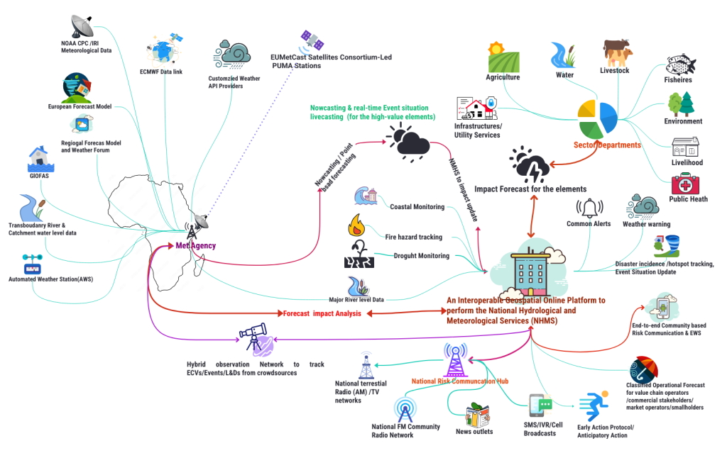
The geospatially enabled MHEWC platform strengthens coordination among climate-vulnerable sector agencies, stakeholders, value-chain actors, and frontline communities by enabling seamless interaction within a unified system. It supports integrated national hydrometeorological services, including impact-based forecasting by sector agencies, operational forecasting, standardized alerting, and real-time event updates.
Ultimately, the integrated framework advances ICT-enabled local risk-governance. It empowers sector departments to conduct multi-hazard exposure, risk, and vulnerability assessments; build and maintain risk repositories; reduce data-exchange barriers across administrative levels; and deliver tailored risk-information services that strengthen local climate resilience.
.
Simplified MHEWS design concept for African Countries (click to enlarge)
Designed & conceptualized by Z M Sajjadul Islam