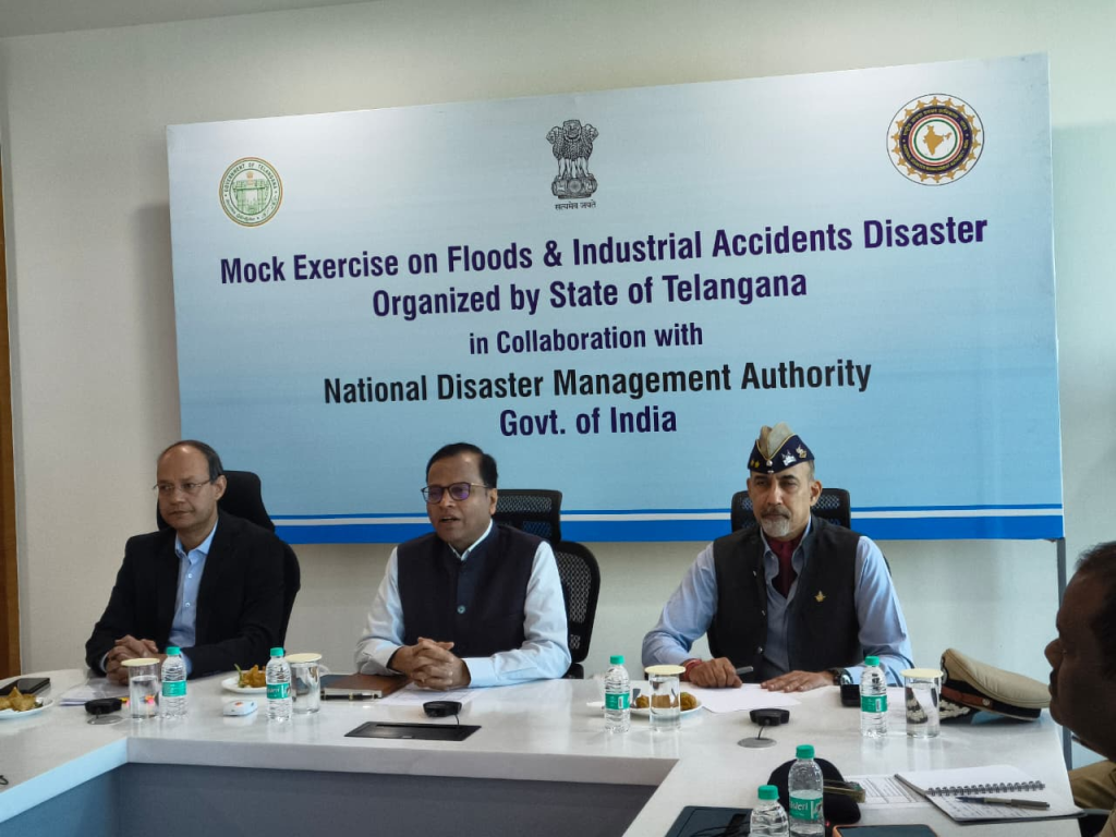
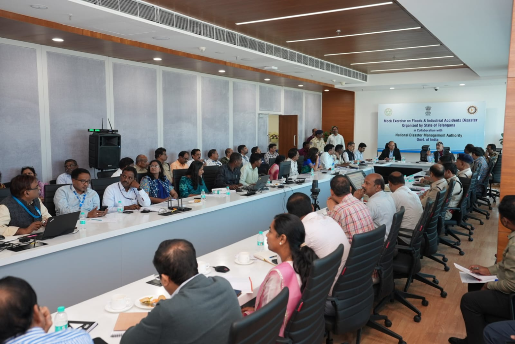
National Disaster Management Authority (India)
The National Disaster Management Authority (NDMA), headed by the Prime Minister of India, is the apex body for Disaster Management in India. Setting up of NDMA and the creation of an enabling environment for institutional mechanisms at the State and District levels is mandated by the Disaster Management Act, 2005.

NDMA is mandated to lay down the policies, plans and guidelines for Disaster Management to ensure timely and effective response to disasters. Towards this, it has the following responsibilities:
- Lay down policies on disaster management;
- Approves the National Plan;
- Approve plans prepared by the Ministries or Departments of the Government of India in accordance with the National Plan;
- Lay down guidelines to be followed by the State Authorities in drawing up the State Plan;
- Lay down guidelines to be followed by the different Ministries or Departments of the Government of India for the purpose of integrating the measures for prevention of disaster or the mitigation of its effects in their development plans and projects;
- Coordinate the enforcement and implementation of the policy and plans for disaster management;
- Recommend provision of funds for the purpose of mitigation;
- Provide such support to other countries affected by major disasters as may be determined by the Central Government;
- Take such other measures for the prevention of disaster, or the mitigation, or preparedness and capacity building for dealing with threatening disaster situations or disasters as it may consider necessary;
- Lay down broad policies and guidelines for the functioning of the National Institute of Disaster Management.
NDMA also equips and trains other Government officials, institutions and the community in mitigation for and response during a crisis situation or a disaster. It works closely with the National Institute of Disaster Management for capacity building. It develops practices, delivers hands-on training and organises drills for disaster management. It also equips and trains disaster management cells at the state and local levels.
NDMA, under the Ministry of Home Affairs can also be assigned with the responsibility for protection of cyber critical infrastructure. As a result NDMA has overlapping responsibilities with CERT-IN of MeitY and NCIIPC of the NTRO when it comes to securing critical/non-critical infrastructure.
NDMA developed guidelines
The following are the guidelines as per NDMA’s official website:
- Guidelines for Preparation of Action Plan – Prevention and Management of Heat Wave
- Landslide Risk Management Strategy
- Guidelines on Disability Inclusive Disaster Risk Reduction
- Guidelines on Temporary Shelters for Disaster-Affected Families
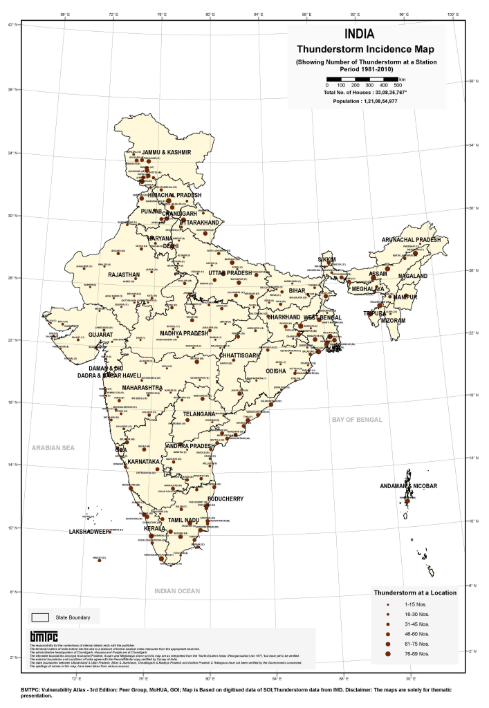
- Guidelines on Prevention & Management of Thunderstorm & Lightning/Squall/Dust/Hailstorm & Strong Winds
- Guidelines on Boat Safety
- Guidelines on Cultural Heritage Sites and Precincts
- Guidelines on Museums
- Guidelines on Minimum Standards of Relief
- Guidelines on Hospital Safety
- Guidelines on School Safety Policy
- Guidelines on Seismic Retrofitting of Deficient Buildings and Structures
- Guidelines on Scaling, Type of Equipment and Training of Fire Services
- Guidelines on National Disaster Management Information and Communication System
- Guidelines on Management of Drought
- Guidelines on Management of Urban Flooding
- Guidelines on Management of Dead in the Aftermath of Disaster
- Guidelines on Management of Tsunamis
- Guidelines on Incident Response System
- Guidelines on Psycho-Social Support and Mental Health Services in Disasters
- Guidelines on Management of Chemical(Terrorism) Disasters
- Guidelines on Management of Landslides and Snow Avalanches
- Guidelines on Management of Nuclear and Radiological Emergencies
- Guidelines on Management of Biological Disasters
- Guidelines on Management of Cyclones
- Guidelines on Management of Floods
- Guidelines on Medical Preparedness and Mass Casualty Management
- Guidelines on Preparation of State Disaster Management Plans
- Guidelines on Chemical Disasters
- Guidelines on Management of Earthquakes


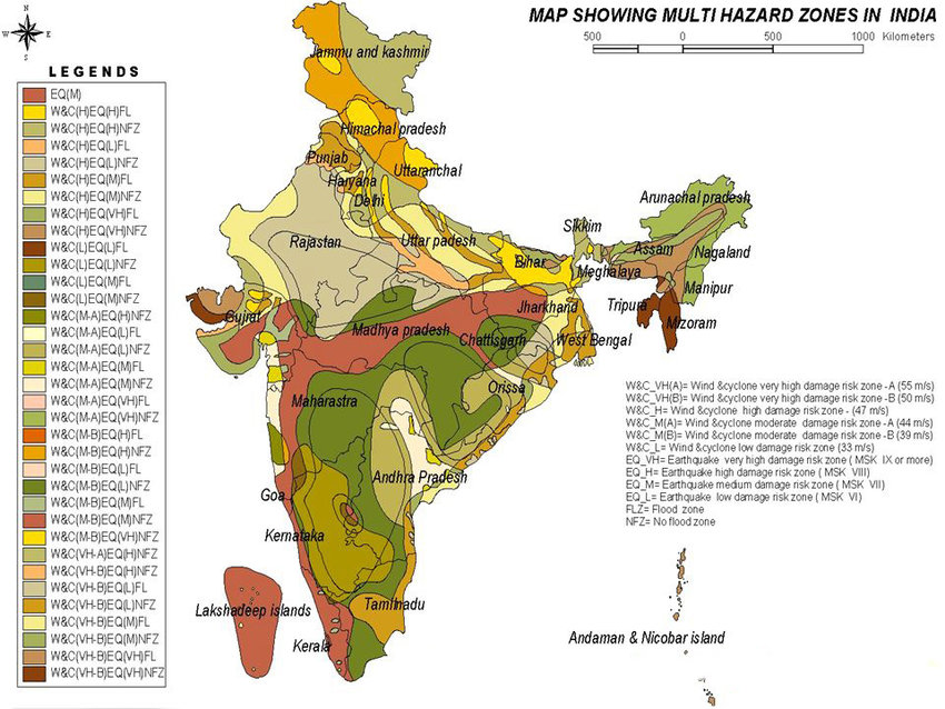
Multi-hazard Phenomena of India
Out of the 36 States and Union Territories in India, 27 are hazard-prone, with about 58.6% of the landmass being prone to earthquakes, 12% to flooding, and 15% to landslides, respectively . Out of 7516 km of coast, 5700 km are vulnerable to cyclones and tsunamis
https://imdpune.gov.in/hazardatlas/floodnew.html
https://imdpune.gov.in/hazardatlas
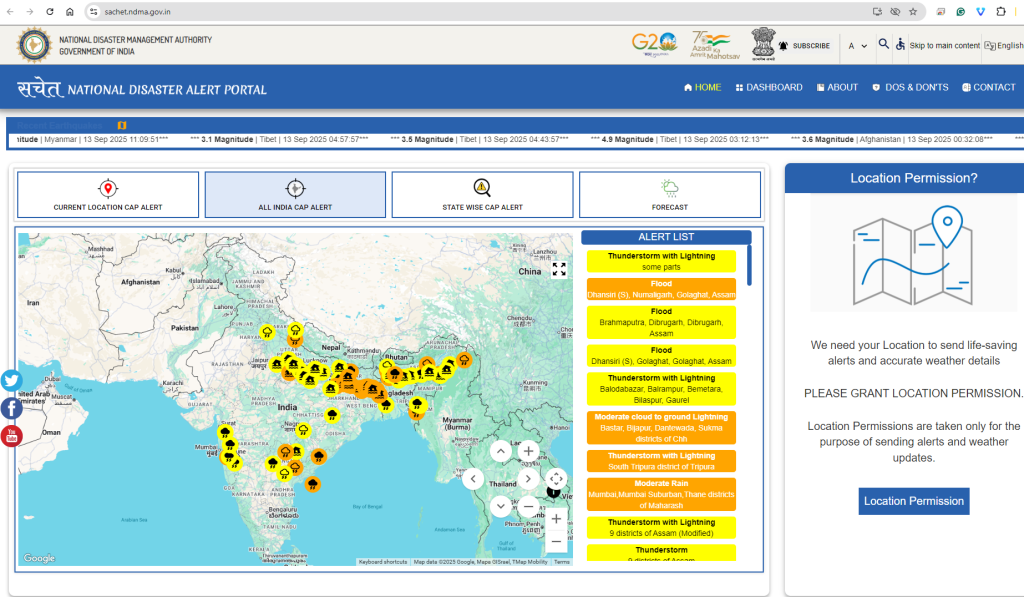
It is strongly advisable to the Nodal agency, NDMA, that your website is running very slowly, and users can hardly access online resources at https://ndma.gov.in. Please optimize your portal with a high-configured server and high-speed internet bandwidth, as this is a national priority.
https://ndma.gov.in/Governance/Guidelines
Hydromet Observation Infrastructures in India
- India Meteorological Department (IMD) Doppler Weather Radar (DWR) Network … In QGIS, these maps are visualized along with the IMD DWR network.
IMD DWR Network
| S No | DWR Station | State | Type of DWR |
| 1 | Agartala | Tripura | S – Band |
| 2 | Bhopal | Madhya Pradesh | S – Band |
| 3 | Bhuj | Gujarat | S – Band |
| 4 | Chennai | Tamil Nadu | S – Band |
| 5 | Cherrapunjee (ISRO) | Meghalaya | S – Band |
| 6 | Delhi (Palam) | Delhi | S – Band |
| 7 | Panaji | Goa | S – Band |
| 8 | Gopalpur | Odisha | S – Band |
| 9 | Hyderabad | Telangana | S – Band |
| 10 | Jaipur | Rajasthan | C – Band |
| 11 | Kolkata | West Bengal | S – Band |
| 12 | Kochi | Kerala | S – Band |
| 13 | Karaikal | Tamil Nadu | S – Band |
| 14 | Lucknow | Uttar Pradesh | S – Band |
| 15 | Machilipatnam | Andhra Pradesh | S – Band |
| 16 | Mohanbari | Assam | S – Band |
| 17 | Mumbai | Maharashtra | S – Band |
| 18 | Nagpur | Maharashtra | S – Band |
| 19 | New Delhi (Mausam Bhawan) | Delhi | C – Band |
| 20 | Paradip | Odisha | S – Band |
| 21 | Patiala | Punjab | S – Band |
| 22 | Patna | Bihar | S – Band |
| 23 | Srinagar | Jammu and Kashmir | X – Band |
| 24 | Thiruvananthapuram (ISRO) | Kerala | C – Band |
| 25 | Visakhapatnam | Andhra Pradesh | S – Band |
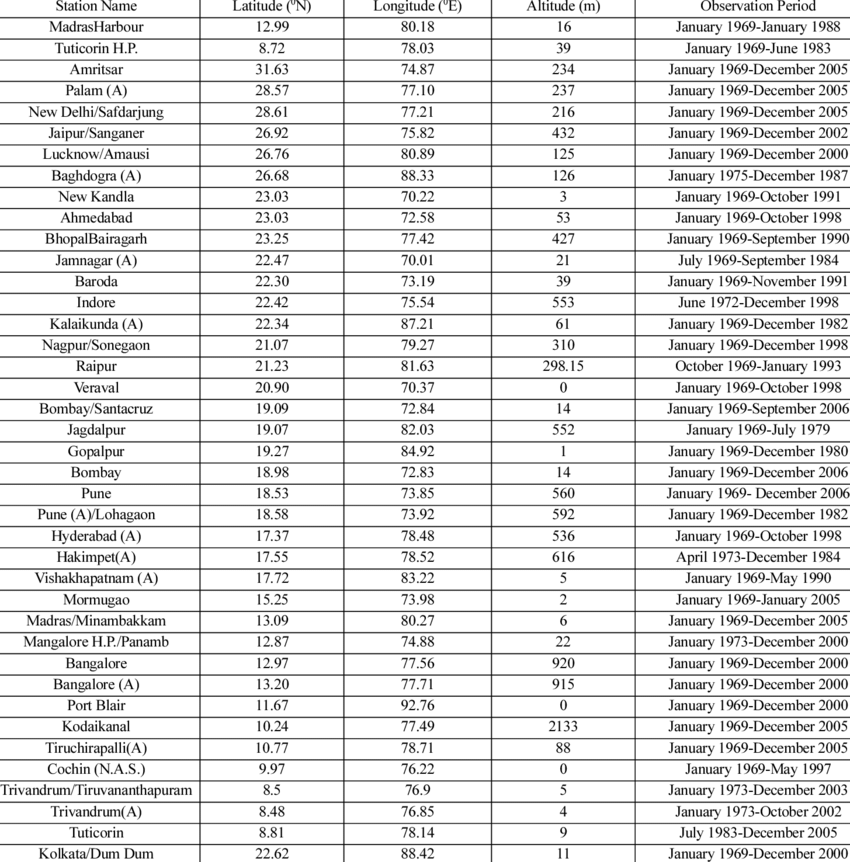
Met Stations
Dynamic Prediction of Lightning Flash Count
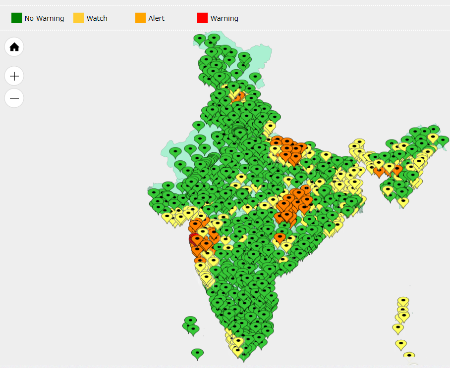
Wind Hazard Map
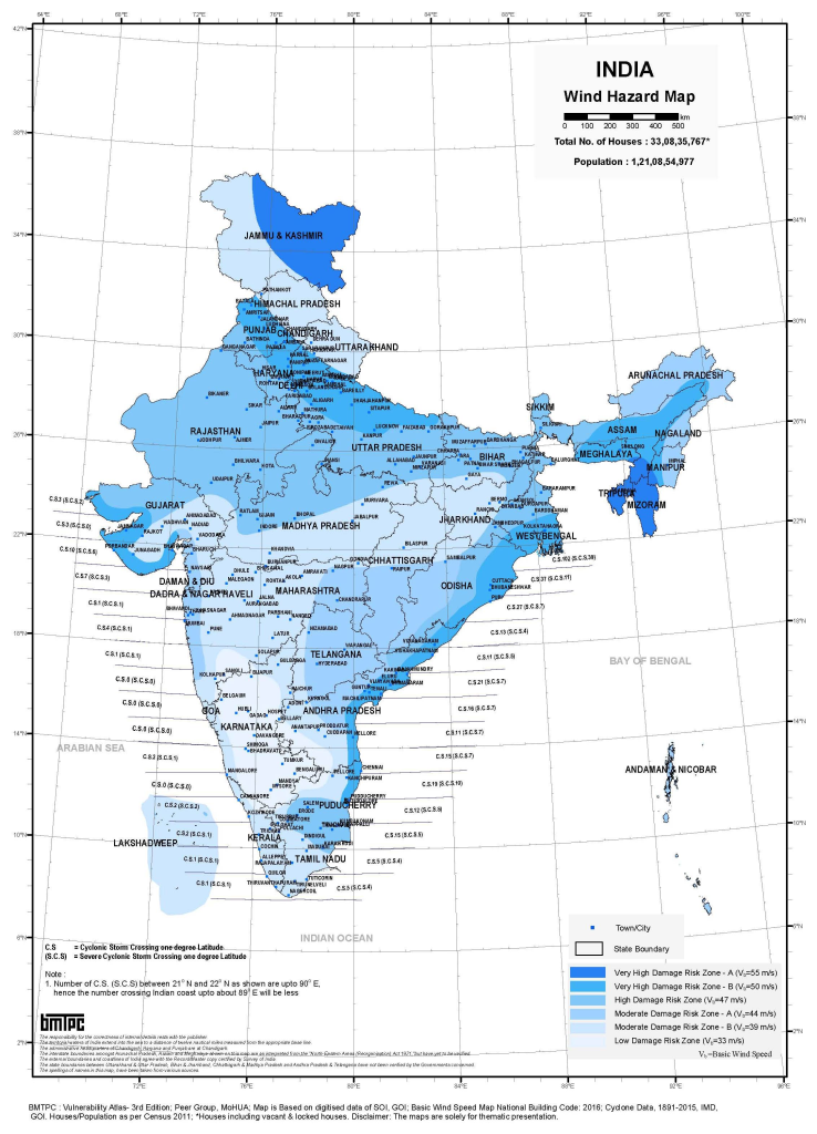
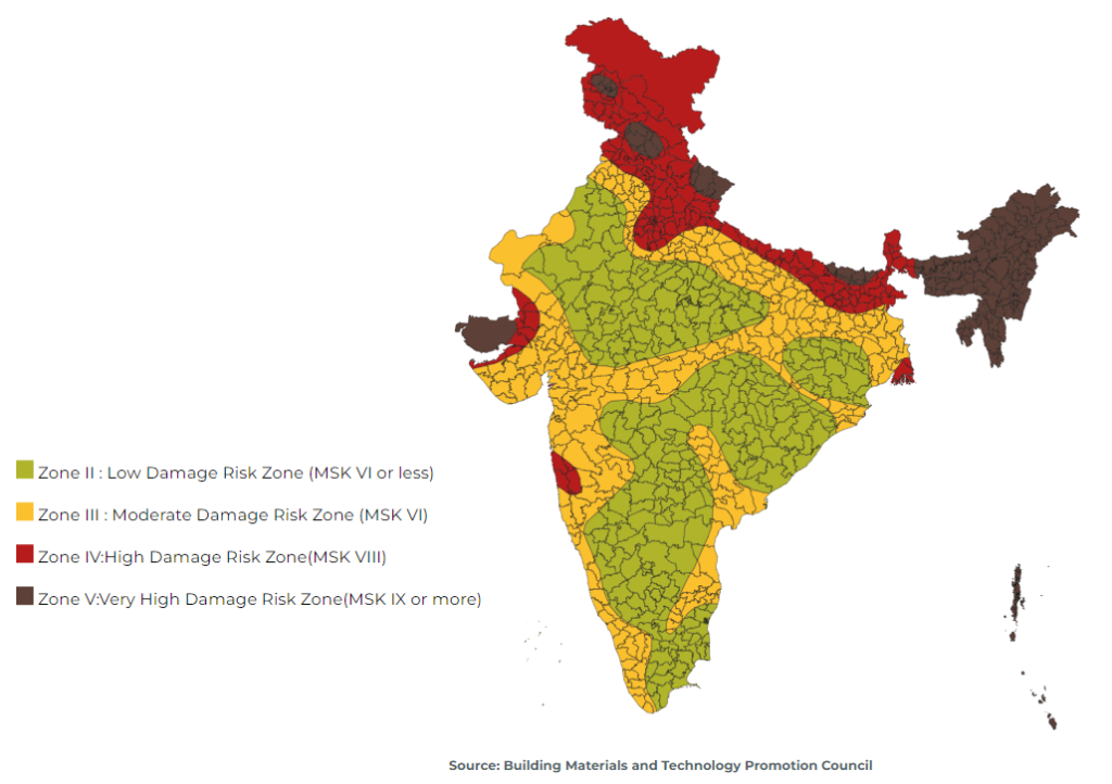
Earthquake Hazard prone area Map
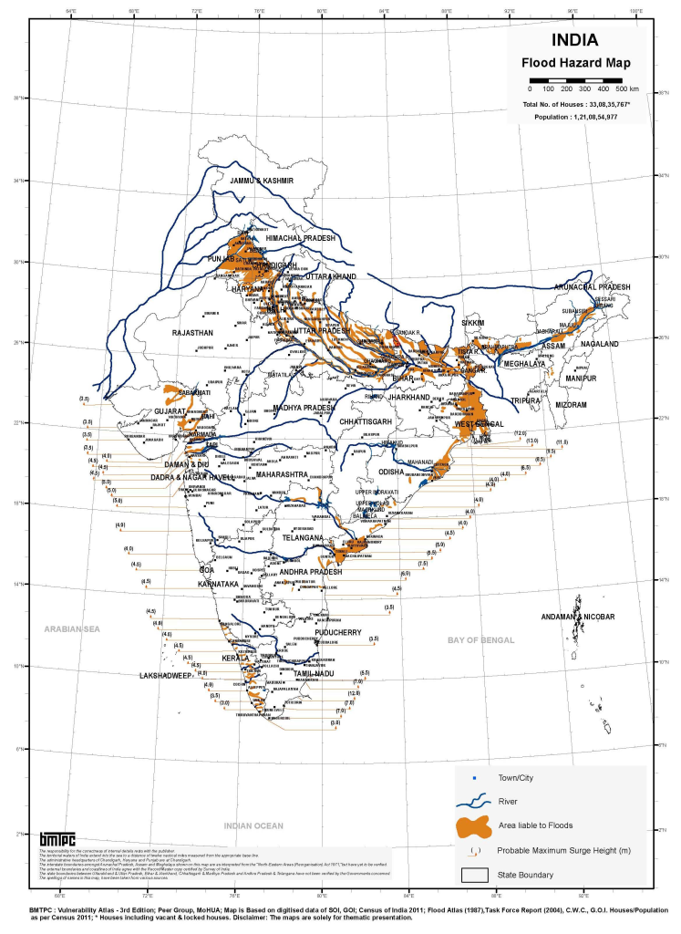
Flood Prone Area Hazard Map
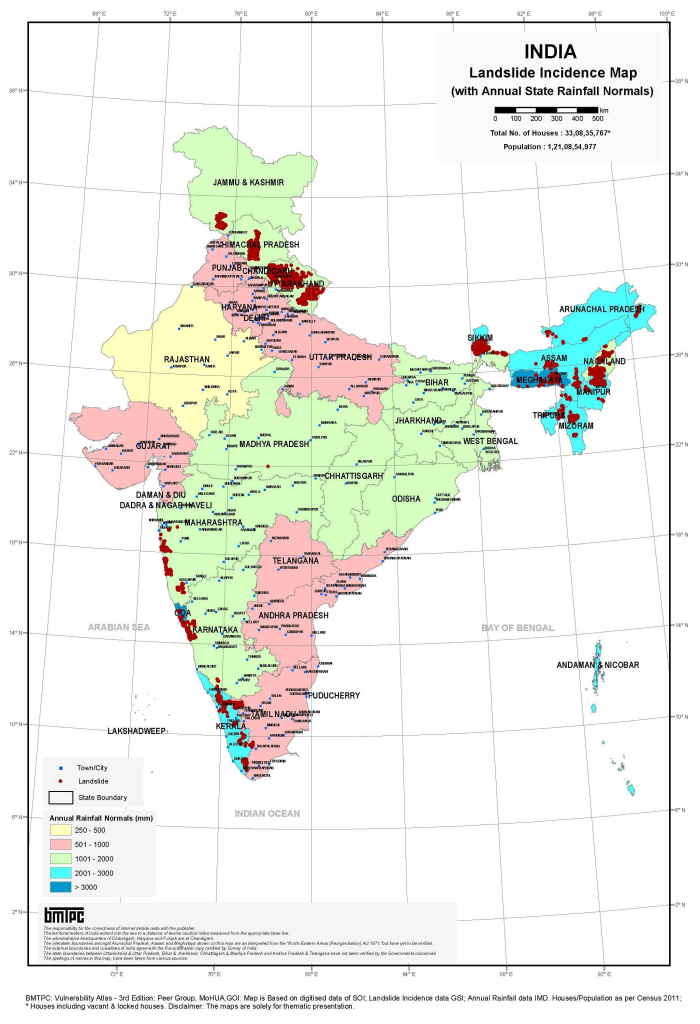
Landsline hazard prone area
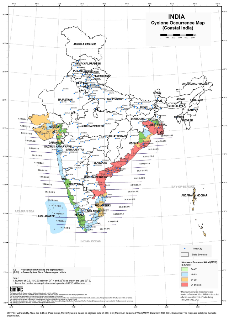
Cyclone vulnerable area
Earthqhake Hazard Prone area
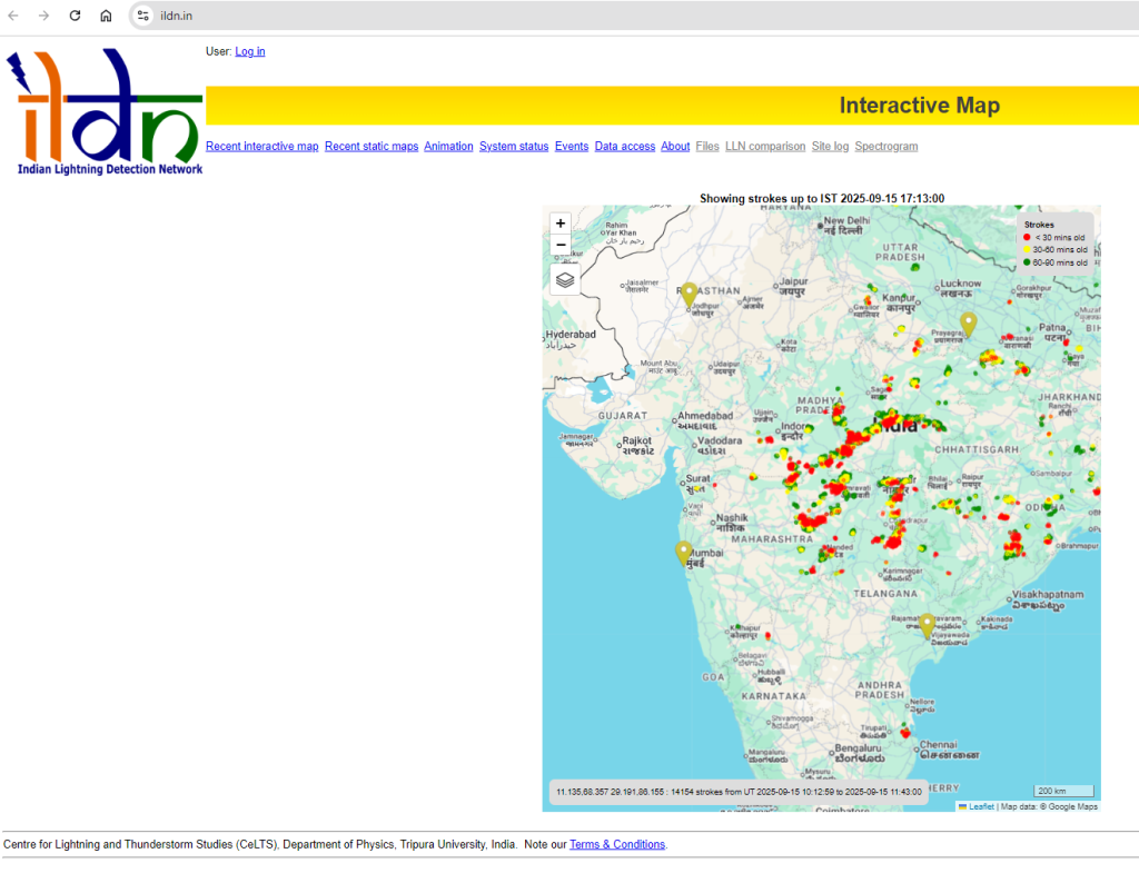
Indian Lighting Detection Network
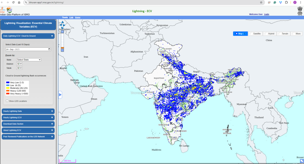
Indian ISRO Running Essential Climate Variables (ECV) Visualization Geoportal ( Realtime Visualization )
INDIAN INSTITUTE OF REMOTE SENSING– Indian Space Research Organisation

Expert comments :