Guatemala

Multi-hazard Early Warning System Design & Implementation Center (MHEWC): A Global Platform for Multi-Hazard Early Warning Systems (MHEWS)-Supporting the Global South

Created with Sketch.

Riesgos climáticos y vulnerabilidades de Guatemala (Climate risk and vulnerabilities of Guatemala)


Guatemala is highly vulnerable to climate change and multi-hazard risks due to its seismic and volcanic setting, mountainous terrain, degraded watersheds, exposure to Pacific and Caribbean storm systems, rural poverty, and dependence on climate-sensitive agriculture. The country faces recurrent threats from earthquakes, volcanic eruptions, hurricanes, tropical storms, floods, landslides, droughts, forest fires, water scarcity, and food insecurity. Climate change is intensifying these risks through rising temperatures, erratic rainfall, longer dry spells, extreme precipitation, drought stress, land degradation, and increasing pressure on agriculture, water resources, ecosystems, infrastructure, and vulnerable communities. Strengthening multi-hazard early warning systems, resilient infrastructure, climate-smart agriculture, watershed management, seismic and volcanic risk reduction, disaster risk financing, and locally led adaptation is essential to reduce losses and protect Guatemala’s development gains.

Guatemala is highly exposed to climate and multi-hazard risks due to its location in Central America’s active seismic and volcanic belt, its mountainous terrain, steep watersheds, Pacific and Caribbean coastal exposure, high rural poverty, degraded ecosystems, and dependence on climate-sensitive livelihoods. The country faces recurrent risks from earthquakes, volcanic eruptions, hurricanes, tropical storms, floods, landslides, droughts, forest fires, coastal hazards, food insecurity, water stress, and climate-related migration pressures. The World Bank and GFDRR identify Guatemala as severely affected by natural hazards including earthquakes, volcanic activity, floods, hurricanes, storms, and landslides.

1. Multi-hazard exposure

Guatemala’s risk profile combines geophysical hazards and hydrometeorological hazards. Earthquakes and volcanic eruptions are major threats because the country lies in a tectonically active region with numerous volcanoes and seismic faults. At the same time, hurricanes, tropical storms, extreme rainfall, river flooding, flash floods, and landslides create recurrent disaster impacts, especially in mountainous and watershed areas. GFDRR notes that Guatemala’s development has repeatedly been disrupted by earthquakes, volcanic eruptions, hurricanes, floods, and forest fires.

Earthquake risk is especially significant. A GFDRR disaster risk profile estimates Guatemala’s annual average loss from earthquakes at about US$325.3 million, equivalent to 0.46% of GDP, compared with US$21.6 million from hurricanes. The same profile estimates a 250-year probable maximum loss of US$7.9 billion for earthquakes, equivalent to 11.2% of GDP.

2. Historical disaster impacts

Guatemala has experienced several catastrophic disaster events. The 1976 earthquake caused more than 23,000 deaths and damages estimated at 17.9% of GDP. Hurricane Mitch in 1998 caused damages estimated at 4.7% of GDP, while Hurricane Stan in 2005 caused damages estimated at 3.4% of GDP. These figures show that disasters in Guatemala are not isolated humanitarian shocks; they are major macroeconomic and development setbacks.

3. Climate change as a risk multiplier

Climate change is intensifying Guatemala’s existing vulnerabilities through rising temperatures, rainfall variability, longer dry spells, extreme rainfall events, drought stress, water scarcity, land degradation, and increased pressure on agriculture and food systems. Guatemala’s climate is highly diverse because of its topography, ranging from humid coastal zones and tropical lowlands to cooler highlands and dry areas. This variation means climate impacts are spatially differentiated: some areas face drought and food insecurity, while others face floods, landslides, and storm-related damage.

The Central American Dry Corridor, which includes parts of Guatemala, is a major climate-risk hotspot. FAO describes the Dry Corridor as highly vulnerable to extreme climate events, where long periods of drought are followed by intense rains, severely affecting livelihoods, food security, and nutrition. In Guatemala, this is especially important for smallholder farmers and basic grain producers who depend on rainfall-sensitive maize and bean production.

4. Key vulnerabilities

Agriculture and food security: Guatemala’s rural livelihoods are highly climate-sensitive. Drought, erratic rainfall, crop failure, soil erosion, pests, and land degradation directly affect smallholder farmers, Indigenous communities, and subsistence producers. USAID’s climate vulnerability profile notes that agriculture contributes more than 13% of GDP and employs nearly 40% of the labor force, making climate shocks highly relevant to livelihoods and national development.

Water resources: Water security is vulnerable to drought, watershed degradation, deforestation, poor water quality, and extreme rainfall. Dry-season scarcity affects households, agriculture, livestock, and ecosystems, while intense rainfall can damage water systems, increase sedimentation, contaminate supplies, and trigger floods and landslides. GFDRR identifies improving water resource quality and quantity as a priority adaptation area for Guatemala.

Floods and landslides: Guatemala’s steep terrain, volcanic soils, degraded slopes, deforestation, intense rainfall, and settlement in high-risk areas increase susceptibility to floods and landslides. These hazards can damage roads, bridges, housing, schools, health facilities, water systems, agricultural land, and rural access routes.

Volcanic and seismic vulnerability: Earthquakes and volcanic eruptions pose severe risks to housing, schools, hospitals, roads, public buildings, cultural heritage, and critical infrastructure. Vulnerability is particularly high where older buildings, informal settlements, weak construction standards, and high population exposure overlap with seismic and volcanic hazard zones.

Social vulnerability: Poor rural households, Indigenous communities, smallholder farmers, women-headed households, children, older persons, people with disabilities, informal settlers, and communities in drought-prone, landslide-prone, flood-prone, or volcanic areas face higher climate and disaster risk. Reuters reported that drought and crop failure are persistent threats in rural Guatemala, particularly in the Dry Corridor, where small and medium farmers and Indigenous people are especially vulnerable to food insecurity.

5. Sector-specific risk summary

SectorMain climate and hazard risks
Agriculture and food securityDrought, erratic rainfall, crop failure, pests, soil erosion, reduced maize and bean yields
Water resourcesDry-season scarcity, poor recharge, watershed degradation, sedimentation, contamination
Housing and settlementsEarthquake damage, landslides, floods, volcanic ash, informal settlement exposure
Transport infrastructureLandslides, bridge damage, road washouts, flood disruption, slope instability
Education and health facilitiesEarthquake exposure, flood damage, service interruption, unsafe buildings
Coastal areasHurricanes, tropical storms, flooding, storm surge, coastal erosion
Ecosystems and forestsDeforestation, land degradation, forest fires, biodiversity loss
Public financeRecurrent disaster losses, recovery costs, reconstruction burdens, disrupted public investment

6. Priority resilience needs

Guatemala’s resilience agenda should prioritize multi-hazard early warning systems, drought early warning and anticipatory action, flood and landslide forecasting, seismic risk reduction, volcanic risk monitoring, climate-smart agriculture, watershed restoration, resilient rural infrastructure, risk-informed land-use planning, climate-resilient water management, ecosystem-based adaptation, shock-responsive social protection, and disaster risk financing.

Guatemala implementa iniciativa Alerta Temprana para Todas las
UNDRR

Guatemala City, 12 March 2024 – Guatemala has committed to enhancing the protection of its people by announcing the national launch of the Early Warnings for All (EW4All) initiative in Guatemala, which aims to provide multi-hazard early warning coverage worldwide by 2027.

This national launch in Guatemala will consolidate multi-agency efforts to address existing gaps in risk knowledge, hazard monitoring and forecasting, warning dissemination and communication, and rapid response.

This implementation is intended to be supported by a robust monitoring and evaluation system that will track towards strengthening the early warning system components.

The initiative seeks to integrate the efforts of UN agencies, NGOs, civil society, the private sector, and academic and research entities to ensure effective implementation and participation of all people, especially vulnerable groups.  

To unify efforts, the collaboration of the Government of Guatemala and the Office of the Resident Coordinator of the United Nations System in Guatemala has been fundamental to launching this initiative.

César Bernardo Arévalo, President of the Republic of Guatemala, highlighted the strategic importance of EW4All to ensure a safer future for Guatemalan society. “We are taking steps to build resilience, moving away from the concept of sole emergency management. We believe in and are committed to a comprehensive vision that guides Guatemalans, both by birth and at heart, toward a genuine reduction of the risks that cause disasters because we are confident that a safer Guatemala is attainable,” said President Arévalo.

Nahuel Arenas García, Chief of UNDRR’s Regional Office for the Americas and the Caribbean, emphasized the correlation between early warning systems and effective and sustainable development. “Countries cannot develop if they are in continuous post-disaster recovery,” said Arenas Garcia. “In a world of interconnected crises and increasing natural hazards, the EW4All initiative is a response towards taking concrete and effective measures to save lives and protect development efforts,” he added.

In Guatemala, the entities designated to lead this process are the Executive Secretariat of the National Coordinator for Disaster Reduction (SE-CONRED), the National Institute of Seismology, Volcanology, Meteorology and Hydrology (INSIVUMEH), and the Ministry of Environment and Natural Resources (MARN).

“This initiative will allow local communities to actively participate in risk management processes, thus enhancing the overall effectiveness of disaster response strategies. Through improved communication, training, and resource allocation, we are committed to building an informed, prepared, and resilient society in the face of adversity,” said José Miguel Barreto, Resident Coordinator of the United Nations in Guatemala. “This launch is confirmation of the intrinsic understanding that peace derives from disaster risk management, as demonstrated by the Agenda 2030 and the Sendai Framework,” he added.

CONRED’s Executive Secretary, Claudinne Ogaldes, highlighted the role of institutional capacity building for efficient implementation.  “It is important to strengthen the capacities of all the institutions of the CONRED System, with the objective of increasing prevention mechanisms for timely response, generating information on potential risks, which must be translated into timely decision-making by communities and local authorities”, she said.

People-centered, end-to-end, multi-hazard early warning systems are one of the best disaster risk reduction and climate adaptation measures for saving lives and reducing economic losses. According to the Global Status of Multi-Hazard Early Warning Systems 2023 report, countries with limited to moderate early warning coverage have disaster mortality rates that are nearly six times higher than those of countries with substantial to comprehensive coverage. Yet despite these benefits, nearly half of the countries of the world lack effective multi-hazard early warning systems.

The EW4All initiative was launched in 2022 to address this gap, and at COP27, the UN Secretary-General introduced an Executive Action Plan for its implementation by 2027, where he asked the United Nations Office for Disaster Risk Reduction (UNDRR) and the World Meteorological Organization (WMO) to co-led the initiative, with support from the International Federation of Red Cross and Red Crescent Societies (IFRC) and the International Telecommunication Union (ITU).

Guatemala Strengthens Its Early Warning System with Support from Japan

Guatemala enhances its early warning system with support from Japan and UNESCO, boosting disaster prevention and response capacity.


Guatemala Strengthens Its Early Warning System with Support from Japan

On the occasion of the International Day for Disaster Risk Reduction, authorities from Guatemala and Japan, together with representatives from UNESCO, presented the outcomes of the Multi-Hazard Early Warning System Workshop. This initiative aims to strengthen Guatemala’s national capacity to anticipate and mitigate natural disasters.

The meeting reaffirmed the country’s institutional commitment to prevention and interagency coordination, two key pillars of the National Plan for Strengthening Early Warning Systems 2024–2027.

Japanese Ambassador, Kuwana Ryosuke, highlighted the geological similarities between the two nations and emphasized the importance of having effective early warning mechanisms that can save lives and reduce damage in vulnerable communities.

Japanese Technology and International Cooperation

Japan has long been a strategic partner for Guatemala in disaster risk management. During the event, Ambassador Ryosuke underscored his government’s interest in continuing to support technology transfer and technical training. He mentioned Japanese companies such as NEC, which have developed seismic and meteorological alert systems already partially implemented in Guatemala. These technologies will make it possible to issue early warnings with greater accuracy and speed in the face of earthquakes, heavy rainfall, or landslides.

Meanwhile, Rodrigo Espinosa, UNESCO Science Officer in Guatemala, explained that the workshop helped generate recommendations to strengthen the four pillars of early warning systems:

  • Risk knowledge
  • Monitoring and alert
  • Effective communication
  • Response capability
Espinosa reminded attendees that “disasters are not natural; what turns them into disasters is our vulnerability,” encouraging a shared sense of responsibility toward prevention.

A Coordinated Network to Reduce Risk

Claudinne Ogaldes Cruz, Executive Secretary of Guatemala’s National Coordinator for Disaster Reduction (CONRED), explained that the national system is built on collaboration among institutions, communities, and international organizations.

She emphasized that early warnings “are not just about technology or protocols, but the bridge that connects science with community action, and prevention with life itself.
Claudinne Ogaldes Cruz & Kuwana Ryosuke

She also noted that Guatemala is in talks with Japanese companies to improve its seismic alert systems, as well as with the CLAR network to implement a cell broadcasting mechanism that would send localized alerts to at-risk populations.

During the workshop’s closing remarks, UNESCO’s headquarters in Paris reaffirmed that Guatemala is among the 15 most vulnerable countries in the world, making it a priority within the Global Early Warning for All Initiative.

Nevertheless, the strengthening of Guatemala’s early warning system—with Japan’s technical support and UNESCO’s guidance—marks a significant step toward a more coordinated and preventive approach to risk management. The combination of international cooperation and local expertise will help the country improve early threat detection and reduce vulnerabilities.

Guatemalan Coordinating Agency for Disaster Reduction (CONRED) https://conred.gob.gt

Municipal Landslide and Flood Hazard Maps
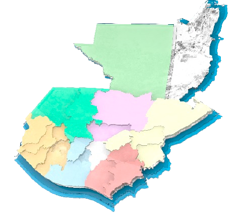
Alta Verapaz

Risk management

A set of actions to prevent, reduce, and respond to disasters, with access to risk maps, alerts, and monitoring platforms.

Maps

Geospatial tools to identify landslide and flood hazards at the national and municipal levels.

INFORM

Index that measures risks, vulnerabilities, and response in municipalities, supporting risk management.

Alerts

Monitoring system and alert levels for risk management, indicating the level of emergency preparedness and response.

The Challenge | Invent Your Own Challenge

The technology innovation for Disaster Management of Guatemala

https://youtube.com/watch?v=_y_Dms2-Nqk%3Frel%3D0

Status of projects in the topic of Disaster Management with the help of young entrepreneurs in Guatemala to support our National Disaster Management Agency, Conred

#DisasterManagement #Guatemala

We will list all resources available up to 2019 here:

National Science Council – Innovation Commission – Innovation in Disaster Management Subcomission – www.concyt.gob.gt

Conred – National Disaster Management and Emergency Agency for Guatemala – www.conred.gob.gt

Upana – Project for Disaster Management – www.upana.edu.gt –

InterU Plataforma Guatemalteca Interuniversitaria para la Gestión de Riesgo de Desastres – InterU- GRD – https://www.galileo.edu/noticias/lanzamiento-interu-plataforma-guatemalteca-interuniversitaria-para-la-gestion-de-riesgo-de-desastres/

Launching of platform in September, 2019: https://www.youtube.com/watch?v=WNHJwnMT8uU

ALERTAFUEGOGT – USAC – WINNER OF #SPACEAPPSGUATEMALA18 – https://2018.spaceappschallenge.org/challenges/volcanoes-icebergs-and-asteroids-oh-my/real-time-fire-app/teams/sparkprojects/project

Here is the video that summarizes and was our #DataBootcamp for #SpaceappsGuatemala19 in October, 2019: https://www.facebook.com/MisEspacialGT/videos/2453762818246670/

INFORM subnational model of Guatemala

Subnational - Guatemala

INFORM Guatemala is a municipal risk index that identifies risks, threats, vulnerabilities and response capacities in the 340 municipalities of Guatemala. The municipal risk index simplifies information about crisis risk. The latest release,   Guatemala  INFORM subnational risk 2021, is comprised of 33 indicators representing the three dimensions of risk: hazard and exposure, vulnerability, and lack of coping capacity.

The results of the Guatemala INFORM index will be used by the National Coordination System for Disaster Risk Reduction (CONRED) for its analysis of risk of humanitarian crisis and disasters, municipal response capacities and potential humanitarian needs. Government institutions, civil society and international cooperation organizations can also use the results to focus the design and implementation of development programs and projects.

The Guatemala INFORM initiative is supported by UNICEF, OCHA and WFP.

Watch the Spanish version of the INFORM video

Please download the Guatemala Documents from the link below

https://drive.google.com/drive/folders/1bOhbzaUpk4dqUqTXemWeTuvR0S3WDD4M?usp=drive_link

Jaxx Wallet Download

Jaxx Liberty Wallet

Jaxx Wallet

gem visa login

gem visa login australia