World Meteorological Organization WMO
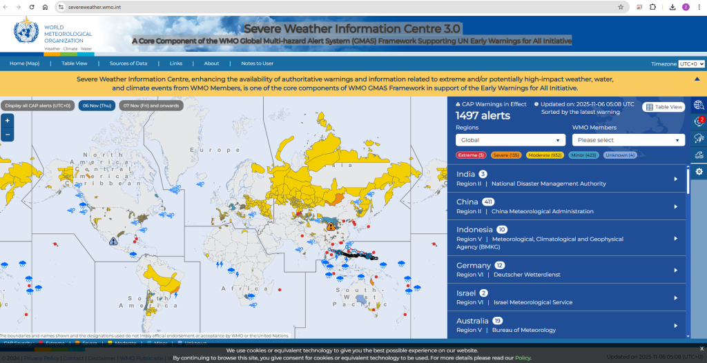
WMO Severe weather portal :
Severe Weather Information Centre 3.0. A Core Component of the WMO Global Multi-hazard Alert System (GMAS) Framework Supporting UN Early Warnings for All Initiative
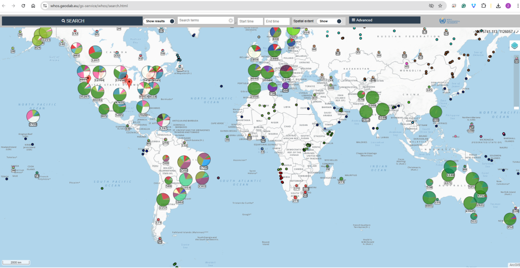
Currently, WHOS makes available three data portals allowing users to easily leverage common WHOS functionalities such as data discovery and data access, on the web by means of common web browsers.
WMO Hydrological Observing System (WHOS) Phase II Global Portal
WHOS Phase II provides a fully WMO Information System (WIS)-compliant services-oriented framework linking hydrologic data providers and users through a hydrologic information system of systems enabling data registration, discovery and access.
The Initial Implementation Plan for WHOS Phase II was endorsed by the WMO Executive Council (EC-70) in June 2018.
WHOS Phase II is designed to offer services that support the operational needs of NHSs as well as the broader scientific needs of the international hydrological community.
All data on the WMO Hydrological Observing System (hereinafter: WHOS) is made available in accordance with WMO data policy, which supports broadening and enhancing, whenever possible, the free and unrestricted1 international exchange of meteorological, hydrological, climatological and related environmental data and products.
Please note that WHOS does not store or archive any data. By leveraging the Discovery and Access Broker technology, WHOS harmonizes, makes interoperable and shares the data that are published by original data providers through their web services.
Please note that not all data available on WHOS have undergone quality control procedures. Please contact the original data provider in order to get detailed information regarding data quality aspects.
By accessing WHOS, the user accepts the Terms of Use specified below.
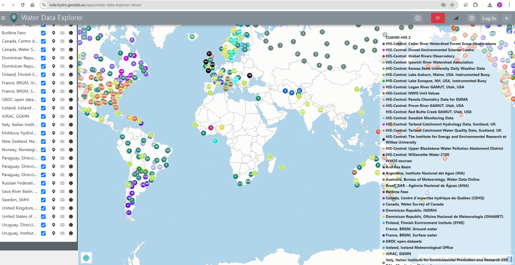
Water Data Explorer (WDE)
1.1. Introduction
In recent years, there has been a growing recognition of the need for standardized ways of sharing water data on the web. In response to this need, the Consortium of Universities for the Advancement of Hydrologic Science (CUAHSI) Hydrologic Information System (HIS) has been developed along with the standardized WaterOneFlow web services and WaterML data exchange format. To access data that are shared using the WaterOneFlow services and WaterML format, tools already exist such as the Microsoft Windows HydroDesktop software , WaterML R package, and the web-based CUAHSI HydroClient which serves as an access point to the CUAHSI HIS database.
Water Data Explorer (WDE) is a newly developed web-based tool allowing a broad range of users to discover, access, visualize, and download data from any Information System that makes available water data in WaterML format through WaterOneFlow services. WDE is designed in a way that allows users to customize it for local or regional web portals.
1.2. WDE Overview
WDE is an open-source web application providing users with the functionalities of data discovery, data access, data visualization, and data downloading from any Information System that makes available water data in WaterML format through WaterOneFlow web services. WDE can be installed by any organization and requires minimal server space.
1.2.1. User Interface
To organize and manage various WaterOneFlow web services, WDE uses Data Views that are organized in Catalogs