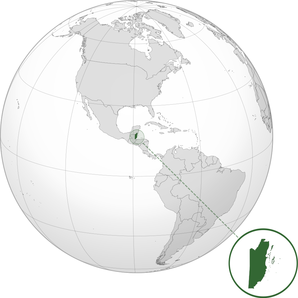
Belize
Belize is highly vulnerable to climate change and natural hazards due to its location in the Atlantic hurricane belt, low-lying coastal geography, concentration of population and economic assets along the coast, and dependence on climate-sensitive sectors such as tourism, agriculture, fisheries, and marine ecosystems. The country faces recurrent and intensifying risks from hurricanes, tropical storms, coastal and inland flooding, storm surge, drought, sea-level rise, coastal erosion, coral bleaching, saltwater intrusion, and ecosystem degradation. These hazards threaten lives, livelihoods, infrastructure, water security, food systems, biodiversity, public finances, and long-term development. Strengthening multi-hazard early warning systems, climate-resilient infrastructure, coastal zone management, ecosystem-based adaptation, disaster risk financing, and risk-informed land-use planning is therefore essential for reducing Belize’s climate and disaster risk.


Belize is highly vulnerable to climate change and natural hazards because its exposure is both geographic and structural. The country lies in the Atlantic hurricane belt, has extensive low-lying coastal areas and offshore cayes, and depends heavily on climate-sensitive sectors such as tourism, agriculture, fisheries, coastal ecosystems, water resources, and marine biodiversity. These conditions mean that hazards such as hurricanes, tropical storms, storm surge, flooding, drought, sea-level rise, coastal erosion, coral bleaching, and saltwater intrusion can rapidly become national development, fiscal, livelihood, and infrastructure crises.
Belize’s risk profile is strongly shaped by its coastal concentration of people, assets, and economic activity. The World Bank notes that nearly 60% of Belize’s population lives near the coast, while more than one-third resides in low-lying areas, increasing exposure to hurricanes, floods, and coastal erosion. It also ranks Belize among the most vulnerable small island developing states for disaster and climate risk. (World Bank) Belize’s Updated NDC similarly highlights that significant portions of the coastline are only one meter or less above sea level, making sea-level rise a major threat to coastal communities, ecosystems, infrastructure, and livelihoods. (UNFCCC)
The country is also highly exposed to hydrometeorological hazards. Belize experiences an annual hurricane season from June to November and, between 1995 and 2021, was affected by nine tropical storms and eight hurricanes. (IISD) Beyond hurricanes, Belize faces floods, droughts, landslides, coastal erosion, and, to a lesser extent, earthquake risk, particularly in the south. A World Bank/GFDRR disaster risk financing document identifies hurricanes, tropical storms, earthquakes, droughts, floods, and landslides as key hazards affecting the country. (World Bank)
Climate change is expected to intensify this risk environment. Observed changes already include rising air temperatures, more hot days, warmer sea surface temperatures, and declining rainfall trends. The IISD climate risk profile reports a 0.45°C rise in mean annual air temperature since 1960, 67 more hot days per year from 1960 to 2003, and an approximate 1.25°C rise in average sea surface temperatures from 2004 to 2024. (IISD) Future projections indicate further warming, more extreme heat, changing precipitation patterns, increased flood risk from intense rainfall, and longer dry seasons. (IISD)
The vulnerability is not only environmental; it is also economic and fiscal. Disasters create recurrent losses, increase post-disaster borrowing needs, and disrupt national development. The World Bank estimates Belize’s average annual disaster-related losses at about US$27 million, while a major disaster could cause damages exceeding US$670 million, nearly one-quarter of GDP. (World Bank) A separate World Bank/GFDRR analysis estimated long-run average annual hurricane damage to public and private building infrastructure at US$17.9 million, equivalent to about 1.03% of GDP. (World Bank)
Belize’s ecosystems are central to both its vulnerability and its resilience. Coral reefs, mangroves, seagrass beds, coastal wetlands, and marine protected areas support tourism, fisheries, biodiversity, shoreline protection, and community livelihoods. However, these same systems are threatened by sea-level rise, ocean warming, ocean acidification, coral bleaching, storm damage, erosion, and changing rainfall patterns. Belize’s NDC emphasizes that coastal wetlands and coral reefs provide important adaptation co-benefits by helping protect vulnerable communities and livelihoods. (UNFCCC)
Detailed Climate and Multi-Hazard Risk and Vulnerability Profile of Belize
- Executive risk overview
Belize is a small Caribbean–Central American state with a highly concentrated and climate-sensitive economy, a long low-lying coastline, extensive wetlands and mangroves, more than 1,060 cayes, major river systems, tropical forests and the ecologically and economically critical Belize Barrier Reef. Its combination of coastal exposure, limited national territory, dependence on tourism, agriculture, fisheries and natural ecosystems, and constrained fiscal and technical capacity creates a high level of systemic climate and disaster vulnerability.
The country is exposed to a broad range of interacting hazards:
- tropical storms and hurricanes;
- coastal storm surge and wave action;
- riverine, flash, pluvial and urban flooding;
- drought and water scarcity;
- extreme heat and heatwaves;
- forest, savannah and agricultural fires;
- sea-level rise, coastal erosion and saltwater intrusion;
- coral bleaching, ocean acidification and marine ecosystem degradation;
- landslides, rockfalls and soil erosion;
- earthquakes and low-probability tsunami impacts;
- vector-, water- and food-borne diseases;
- agricultural pests and livestock disease;
- technological, pollution and infrastructure hazards.
The highest national risk is generated not by one hazard in isolation but by compound and cascading events. Examples include:
Drought and extreme heat → water shortages and crop stress → wildfires → forest and agricultural losses → intense rainfall on burned land → erosion, debris flows and water contamination.
Another major pathway is:
Tropical cyclone → storm surge, extreme rainfall and river flooding → damage to housing, roads, electricity, water supply, agriculture and tourism → livelihood interruption, displacement and increased public debt.
Belize’s recent NDC reports that weather-related events have historically caused losses equivalent to about 4% of GDP annually, although estimates differ depending on hazard coverage, methodology and the value of assets included. A 2025 World Bank assessment estimated total average annual disaster losses at approximately US$27 million and warned that a major disaster could cause more than US$670 million in damage—nearly one quarter of national GDP.
- Geographic and socioeconomic context
Belize covers approximately 22,966 km² and is divided into six districts: Corozal, Orange Walk, Belize, Cayo, Stann Creek and Toledo. Its physical geography ranges from flat northern plains and wetlands to the low-lying central and eastern coastal zone, offshore cayes and atolls, and the Maya Mountains and associated uplands in the south and west. The country has approximately 386 km of coastline and more than 1,060 cayes.
This geography produces sharply differentiated risk conditions:
Geographic zone | Principal risk characteristics |
Northern plains | Drought, heat, agricultural water stress, wildfire, river flooding and hurricane impacts |
Central river basins | Riverine and flash flooding, urban flooding, infrastructure disruption and agricultural losses |
Belize City and coastal plain | Storm surge, coastal and pluvial flooding, sea-level rise, erosion, drainage failure and saltwater intrusion |
Offshore cayes and atolls | Hurricane winds, surge, wave action, coastal erosion, freshwater scarcity and coral degradation |
Maya Mountains and western uplands | High-intensity rainfall, flash floods, landslides, erosion, wildfire and road-access constraints |
Southern coastal and riverine zone | Torrential rainfall, flooding, landslides, storm surge, erosion, wildfire and livelihood vulnerability |
Belize’s population was estimated at about 441,000 in March 2025. Approximately 22% of Belizeans were living in multidimensional poverty, while limited revenue generation, a debt-to-GDP ratio above 60% and dependence on imported goods and services constrain the government’s capacity to finance repeated disaster response and resilient reconstruction.
- Climate characteristics
3.1 Climatic zones
Belize has three principal climatic regimes:
- tropical savannah conditions in much of the north;
- tropical monsoon conditions in the central region;
- tropical rainforest conditions in southern Belize.
The country has a pronounced wet season and dry season, although official sources differ slightly on their precise timing. In general, the wet period extends from approximately May or June to October or November, while the dry season extends from approximately November or December to April or May.
Mean annual temperatures range broadly from about 20°C in higher elevations to approximately 29.5°C in warmer lowland locations. Relative humidity averages around 80%. Annual precipitation varies greatly, from approximately 1,500 mm in northern Belize to around 3,800 mm in the south, reflecting the influence of the Maya Mountains and moisture-bearing Caribbean air.
Belize lies within the Atlantic hurricane belt, and the official hurricane season runs from June through November. Between 1995 and 2021, the country experienced damaging effects from nine tropical storms and eight hurricanes.
3.2 Observed climatic changes
Since 1960, Belize’s mean annual air temperature has risen by approximately 0.45°C. Historical analyses indicate that the country experienced about 67 additional hot days per year and 21 fewer cold days per year between 1960 and 2003. Average sea-surface temperature in Belizean waters increased by approximately 1.25°C between 2004 and 2024.
Mean annual rainfall has shown an overall declining tendency, although year-to-year variability remains high. At the same time, heavy rainfall events associated with tropical disturbances, convergence zones and intense convective systems continue to cause severe local flooding. Tropical Storm Sara made landfall in Belize in November 2024 and produced intense rainfall, strong winds and flash flooding in parts of the country.
3.3 Future climate change
Current national projections point toward:
- continuing increases in average and extreme temperatures;
- longer and hotter dry periods;
- declining mean annual rainfall across much of the country;
- increased drought risk, particularly in northern and central Belize;
- heavier and more erratic wet-season rainfall;
- more frequent coastal and inland flooding;
- warmer and more acidic marine waters;
- intensification of storm-surge, erosion and coastal-inundation risks;
- increasing pressure on freshwater, forests, agriculture, fisheries and human health.
Belize’s 2025 NDC indicates that mean rainfall is expected to decline across much of the country, while localized rainfall may increase near the southern mountains. It also anticipates more torrential wet-season rainfall, producing the apparently contradictory but operationally critical combination of more drought and more severe flooding.
Sea level could rise by as much as approximately 103.9 cm by 2100 under a high-end national projection. Such a rise would significantly increase chronic coastal flooding, storm-surge penetration, shoreline retreat, salinization of groundwater and soils, and pressure on mangroves, coral reefs, settlements and critical infrastructure.
- National multi-hazard risk matrix
The following ratings are a qualitative synthesis of national exposure, potential consequences and current vulnerability.
Hazard | Indicative risk | Principal exposed elements |
Hurricanes and tropical storms | Very high | Entire country, especially coast, cayes, tourism centres, agriculture and utilities |
Storm surge and coastal flooding | Very high | Belize City, coastal settlements, cayes, ports, airports and tourism infrastructure |
Riverine and flash flooding | Very high | Belize, Cayo, Stann Creek and Toledo districts; river communities and road networks |
Drought and water scarcity | High–very high | Corozal, Orange Walk, Belize and Cayo districts; agriculture and rural water systems |
Extreme heat | High and increasing | Urban residents, outdoor workers, farmers, children, elderly people and ecosystems |
Wildfire | High | Toledo, Cayo, savannah, pine forest, farmland and protected areas |
Sea-level rise and coastal erosion | Very high, long-term | Coast, cayes, wetlands, housing, tourism, fisheries and freshwater resources |
Coral bleaching and marine degradation | Very high | Belize Barrier Reef, fisheries, tourism and coastal protection |
Landslides and debris flows | Moderate–high locally | Maya Mountains, Mountain Pine Ridge, steep roads and southern watersheds |
Earthquake | Moderate | Buildings, bridges, dams, utilities and emergency facilities |
Tsunami | Low probability but consequential | Low-lying coast, cayes, ports and tourism areas |
Disease outbreaks | High climate sensitivity | Urban and rural communities, health facilities, water systems and workers |
Technological and pollution incidents | Localized but potentially severe | Ports, fuel storage, industry, waste facilities, roads and marine ecosystems |
- Tropical cyclones, hurricanes and severe storms
5.1 Nature of the hazard
Tropical cyclones are Belize’s most destructive rapid-onset hazard. Their impacts are generated by several simultaneous processes:
- extreme winds;
- storm surge;
- high waves;
- coastal and river flooding;
- torrential rainfall;
- lightning and tornado-like wind phenomena;
- erosion and sediment movement;
- fallen trees and debris;
- prolonged utility outages.
Hurricane risk considerably exceeds earthquake risk in economic terms. One probabilistic profile estimated hurricane-related average annual loss at US$7.7 million and a 250-year probable maximum hurricane loss of approximately US$383 million, equal to 22.6% of GDP at the time of the assessment. These figures are narrower than the newer all-hazard World Bank estimate because they measure a specific asset portfolio and use an earlier exposure baseline.
Recent major shocks have included Hurricane Nana in 2020, Hurricane Lisa in 2022 and tropical storms Nadine and Sara in 2024. These events illustrate that Belize may suffer significant flooding and infrastructure disruption even when a storm is not classified as a major hurricane at landfall.
5.2 Principal vulnerabilities
Cyclone vulnerability is heightened by:
- settlements located at or only slightly above sea level;
- lightweight and inadequately secured housing;
- informal construction and inconsistent building-code enforcement;
- exposed electricity, telecommunications and water networks;
- concentration of tourism infrastructure along beaches and cayes;
- bridges and highways crossing flood-prone rivers;
- limited evacuation routes from cayes and peninsulas;
- insufficient drainage in rapidly developing settlements;
- loss or degradation of mangroves, reefs and coastal wetlands;
- limited financial reserves among households and small businesses.
Wood-framed single-family buildings have been identified as a major source of hurricane-related annual loss, illustrating the importance of roof-to-wall connections, hurricane straps, shutters, elevation and code-compliant reconstruction.
- Riverine, flash, coastal and urban flooding
Flooding is a nationwide risk but varies by district and catchment. The principal flood types are:
Riverine flooding
Heavy or prolonged rainfall raises water levels in the Belize, Macal, Mopan, Sibun, New River, Hondo, Sittee, North Stann Creek, South Stann Creek, Monkey, Deep and other river systems. Upstream rainfall can cause downstream flooding after local rainfall has stopped.
Flash flooding
Small, steep catchments near the Maya Mountains and southern uplands can respond rapidly to intense rainfall. Flash floods carry sediment, logs and debris, damage bridges and culverts, isolate settlements and threaten people attempting to cross flooded roads.
Urban and pluvial flooding
Belize City, Belmopan, San Ignacio–Santa Elena, Orange Walk, Dangriga, Punta Gorda and other urban centres face flooding where rainfall exceeds drainage capacity or where drains are obstructed by waste, sediment and unregulated development.
Coastal flooding
Storm surge, wave setup, high tides and heavy rain may occur simultaneously, preventing urban and river drainage and increasing flood depth and duration.
All six districts are expected to experience increasing flood risk. The Belize District is particularly exposed to river overflow and low-elevation coastal flooding, while Corozal and Orange Walk face hurricane-related inundation as well as river and drainage flooding.
Flood consequences include:
- damage to homes, schools, clinics and businesses;
- highway, bridge and culvert failure;
- isolation of rural and Indigenous communities;
- crop, livestock and stored-food losses;
- electricity and telecommunications failure;
- contamination of wells and piped-water systems;
- wastewater and solid-waste dispersal;
- increased dengue, gastrointestinal and skin-disease risk;
- school and livelihood interruption.
Flooding also removes fertile topsoil, erodes riverbanks and beaches, contaminates water resources and damages agricultural infrastructure.
- Drought and water-security risk
Drought is especially important in northern and central Belize, where rainfall is lower, the dry season is more pronounced and agriculture requires reliable soil moisture and water availability. Drought conditions may be meteorological, agricultural, hydrological or ecological.
Major drought impacts include:
- declining river and reservoir levels;
- reduced groundwater recharge;
- shortages in rural and island water systems;
- crop failure and delayed planting;
- livestock heat and water stress;
- pasture and fodder deterioration;
- increased irrigation demand;
- higher wildfire probability;
- reduced hydropower reliability;
- ecosystem degradation and wildlife movement;
- conflict among domestic, agricultural, tourism and ecological water uses.
Belize experienced a prolonged drought in 2019, and drought conditions contributed directly to the destructive 2024 wildfire season.
Climate change is expected to produce longer and hotter dry periods, particularly affecting Corozal, Orange Walk and central agricultural areas. At the same time, population growth, tourism development and agricultural demand may increase abstraction from rivers and aquifers. Coastal aquifers and cayes face the additional risk of saltwater intrusion resulting from sea-level rise, over-abstraction and storm-surge inundation.
- Extreme heat and heatwaves
Increasing temperature is a cross-cutting risk that amplifies drought, wildfire, water demand, crop stress, coral bleaching and human-health impacts.
Highly exposed groups include:
- agricultural and construction workers;
- fishers and tourism workers;
- people living in poorly ventilated housing;
- elderly people;
- young children;
- pregnant women;
- people with cardiovascular, respiratory or renal disease;
- households without dependable electricity or cooling;
- firefighters and emergency personnel.
Heat exposure can cause dehydration, heat exhaustion, heat stroke, reduced labour productivity and worsening of chronic disease. Children, elderly people and pregnant women face disproportionate physiological risk.
High nighttime temperatures are especially hazardous because they limit physiological recovery. Heat can also reduce school performance, damage road surfaces, increase electricity demand and contribute to food spoilage and cold-chain failure.
- Forest, savannah and agricultural wildfire
Wildfire is an increasingly serious hazard in Belize’s broadleaf forest, pine forest, savannah and agricultural landscapes. Fires may originate from land clearing, escaped agricultural burning, hunting, waste burning, lightning, negligence or deliberate ignition. Their spread is controlled by temperature, humidity, wind, vegetation dryness and fuel accumulation.
The 2024 wildfire emergency demonstrated the potential severity of this hazard. CDEMA reported that more than 10,000 hectares of agricultural land were destroyed, approximately 200 homes were affected and damages exceeded US$8 million. The fires particularly affected Cayo and Toledo districts, including Indigenous and farming communities around Punta Gorda.
Wildfires produce multiple cascading impacts:
- destruction of farms, orchards, livestock and stored food;
- smoke-related respiratory and cardiovascular illness;
- loss of biodiversity and wildlife habitat;
- damage to electricity and telecommunications infrastructure;
- contamination of surface water with ash and sediment;
- reduction in tourism activity;
- soil sterilization and erosion;
- landslide and debris-flow risk after heavy rain;
- release of carbon stored in forests and soils.
The combination of drought, high temperature, limited firefighting water, difficult terrain, insufficient equipment and remote settlements complicates suppression operations.
- Sea-level rise, storm surge and coastal erosion
Belize’s flat coastal plain, offshore cayes, mangrove wetlands and coastal concentration of settlements and economic assets make sea-level rise an existential long-term development concern.
Principal impacts include:
- more frequent tidal and nuisance flooding;
- deeper storm-surge inundation;
- accelerated beach and shoreline erosion;
- permanent land loss in very low-lying areas;
- saltwater intrusion into wells and aquifers;
- salinization of agricultural soils;
- septic-system and wastewater failure;
- damage to roads, ports, airports and tourism properties;
- displacement and relocation of coastal communities;
- loss of cultural, archaeological and burial sites.
Coastal erosion is already visible in communities such as Dangriga, Hopkins, Placencia, Seine Bight, Monkey River, Sarteneja and settlements on Ambergris Caye and Caye Caulker. Hard engineering undertaken without sediment, reef, mangrove and shoreline-process analysis can transfer erosion to adjacent areas.
Mangroves, seagrass beds, reefs and coastal wetlands are protective infrastructure. Their degradation increases the wave energy and storm surge reaching settlements. Belize’s NDC identifies mangrove and coral-reef protection as essential for both climate adaptation and national economic resilience.
- Coral reefs, ocean warming and marine hazards
The Belize Barrier Reef system underpins tourism, fisheries, cultural identity, biodiversity and coastal protection. It is threatened by:
- rising sea-surface temperature;
- coral bleaching;
- marine heatwaves;
- ocean acidification;
- hurricane wave damage;
- sedimentation from watersheds;
- sewage and nutrient pollution;
- overfishing and habitat degradation;
- coastal construction;
- sargassum accumulation.
Warmer water causes corals to expel their symbiotic algae, producing bleaching and, where heat stress persists, coral mortality. Ocean acidification reduces the ability of corals and shell-forming organisms to build and maintain calcium-carbonate structures.
Reef decline produces several simultaneous losses:
- reduced fish habitat and fisheries productivity;
- lower tourism value;
- weaker natural protection from waves and storm surge;
- declining biodiversity;
- increased beach erosion;
- loss of cultural and community livelihoods.
Fishers are already reporting the need to travel farther and spend more money to maintain catches, while storms damage boats, engines and fishing equipment. Tourism operators face reef degradation, beach loss, extreme heat and the costs of clearing sargassum and restoring shorelines.
- Landslides, erosion and debris flows
Landslide susceptibility is concentrated in the Maya Mountains, Mountain Pine Ridge and steep parts of the Cayo, Stann Creek and Toledo districts. National susceptibility is generally considered moderate, but localized risk can be high where intense rainfall interacts with steep slopes, weak soils, road cutting, deforestation, wildfire or poorly managed drainage.
Potential impacts include:
- blockage or destruction of mountain roads;
- isolation of rural communities;
- damage to bridges and culverts;
- sedimentation of rivers and reservoirs;
- destruction of farms and forest;
- injury or death;
- interruption of tourism access;
- damage to water pipelines and electricity systems.
Post-wildfire terrain is particularly dangerous because vegetation and root systems that previously stabilized soil may be destroyed. High-intensity rainfall on burned slopes can generate rapid runoff, erosion and debris flows.
- Earthquake and tsunami risk
Earthquake risk is lower than hurricane risk but remains relevant for risk-sensitive construction and critical infrastructure. Available global screening classifies Belize’s earthquake hazard as medium, while detailed regional modelling indicates that Belize has lower seismic exposure than most other Central American countries.
Earthquakes could affect:
- older or non-engineered buildings;
- bridges and elevated water tanks;
- dams and hydropower facilities;
- hospitals, schools and emergency centres;
- ports, fuel storage and industrial facilities;
- electricity and telecommunications systems.
The national tsunami hazard is generally classified as low, but it is not zero. Offshore Caribbean earthquakes can trigger tsunami advisories, and low-lying coastal settlements and cayes may have limited evacuation time and vertical shelter options. Belize has therefore continued strengthening tsunami preparedness.
- Sectoral vulnerability
14.1 Agriculture and food security
Agriculture is exposed to hurricanes, drought, floods, extreme heat, wildfire, saltwater intrusion, pests and changing growing seasons.
Key impacts include:
- reduced yields;
- delayed or failed planting;
- crop lodging from strong winds;
- topsoil loss and nutrient leaching;
- destruction of irrigation, storage and processing facilities;
- livestock mortality and disease;
- transport interruption between farms and markets;
- increased costs for irrigation, insurance and replanting;
- food-price volatility.
Subsistence and small-scale farmers are particularly vulnerable because they frequently lack irrigation, savings, insurance, machinery and access to climate information. Community assessments report that drought and heat have altered planting calendars and reduced productivity, while floods and fires have caused crop, livestock and infrastructure losses.
14.2 Fisheries and aquaculture
Fisheries face marine heatwaves, coral decline, ocean acidification, storms, mangrove loss, changing species distribution and coastal water pollution.
These pressures can:
- reduce fish and lobster productivity;
- force fishers to travel farther offshore;
- increase fuel and safety costs;
- damage boats, traps, engines and landing sites;
- interrupt cold storage and market access;
- intensify competition over declining resources.
Small-scale fishers and coastal processing workers may have little livelihood diversification or financial protection against prolonged closures.
14.3 Tourism
Tourism is highly exposed because much of its infrastructure and attraction base is located along beaches, cayes, reefs, rivers and forests.
Risk factors include:
- hurricane damage to hotels and tourism facilities;
- airport, port and road interruption;
- beach erosion;
- coral bleaching;
- sargassum influx;
- excessive heat;
- wildfire smoke;
- water shortages;
- ecosystem and wildlife loss;
- reputational impacts following disasters.
The sector’s dependence on functioning ecosystems means that environmental degradation can produce economic losses even without a formally declared disaster.
14.4 Water and sanitation
Water infrastructure is exposed to drought, flooding, salinity, sedimentation, contamination, power outages and physical damage.
Critical vulnerabilities include:
- shallow or poorly protected wells;
- limited storage in rural and island communities;
- dependence on electricity for pumping;
- inadequate wastewater systems;
- saltwater intrusion;
- flood contamination of surface-water intakes;
- limited redundancy in treatment and distribution networks.
14.5 Health
Climate-sensitive health threats include:
- heat exhaustion and heat stroke;
- dengue and other mosquito-borne diseases;
- diarrhoeal and water-borne disease following floods;
- smoke-related respiratory illness;
- injury during hurricanes, fires and floods;
- food insecurity and malnutrition;
- mental-health impacts from loss and displacement;
- interruption of medicines, dialysis, maternal care and emergency services.
Health facilities themselves may be exposed to wind, flood, heat, utility failure and access disruption.
14.6 Housing, settlements and infrastructure
Housing risk is highest where buildings are:
- located in floodplains or along eroding coasts;
- constructed without engineered foundations;
- inadequately connected from roof to wall and wall to foundation;
- built from weak or deteriorated materials;
- not elevated above expected flood levels;
- dependent on vulnerable access roads.
Roads and bridges are critical because relatively few national corridors connect districts, markets, ports and the international airport. Failure of one bridge or highway segment can isolate large areas and interrupt emergency assistance.
14.7 Forests and biodiversity
Belize’s forests, savannahs, wetlands and protected areas support biodiversity, tourism, watershed regulation, food, medicine and carbon storage. They are vulnerable to wildfire, drought, hurricane blowdown, invasive species, land conversion, illegal extraction and habitat fragmentation.
Hurricanes can create large quantities of dead woody material, increasing fuel available for subsequent dry-season fires. Drought and fire can then reduce forest recovery and accelerate ecosystem conversion.
- Geographic risk hotspots
Corozal District
Principal hazards include drought, heat, agricultural water stress, hurricane wind, storm surge, coastal erosion, saltwater intrusion and river or drainage flooding. Low-lying coastal communities and the Corozal Bay zone are particularly sensitive.
Orange Walk District
Major risks include drought, heat, wildfire, agricultural losses, river flooding and tropical-cyclone rainfall. Water availability and crop productivity are critical concerns during prolonged dry periods.
Belize District
Belize District contains the country’s largest concentration of people, businesses, infrastructure and public assets. Belize City is exceptionally exposed to storm surge, coastal flooding, river overflow, intense rainfall, drainage congestion, sea-level rise and erosion. Its low-lying topography allows flooding from swollen rivers, heavy rainfall and surging seas to affect broad parts of the urban area.
Hattieville and Mahogany Heights have also been identified as highly vulnerable terrestrial communities because of combined sensitivity and limited adaptive capacity.
Cayo District
Cayo faces riverine and flash flooding along the Macal, Mopan and Belize River systems, drought, heat, wildfire and localized landslides. San Ignacio–Santa Elena, low crossings and communities near rivers face repeated disruption. Mountain Pine Ridge and forested areas are vulnerable to drought-related fire and post-fire erosion.
Stann Creek District
Stann Creek is exposed to hurricanes, storm surge, river flooding, flash floods, erosion, landslides and coastal ecosystem degradation. Dangriga, Hopkins, Seine Bight, Placencia and Riversdale face varying combinations of coastal flooding, beach loss, tourism disruption and marine-resource decline.
Placencia was ranked as the most vulnerable of seven marine communities in one recent assessment because of high exposure and sensitivity and relatively low adaptive capacity.
Toledo District
Toledo has high rainfall but also experiences drought, wildfire and water-access problems. Its hazards include tropical-cyclone rainfall, river and flash flooding, landslides, erosion, wildfire and road isolation.
Maya and other rural communities may be highly dependent on subsistence agriculture, forests and local water resources. The 2024 fires caused extensive agricultural and livelihood losses across communities around Punta Gorda.
Cayes and offshore islands
Ambergris Caye, Caye Caulker and smaller cayes face:
- hurricane wind;
- storm surge;
- wave action;
- beach erosion;
- sea-level rise;
- freshwater scarcity and salinity;
- sewage and solid-waste constraints;
- coral bleaching and reef decline;
- limited evacuation routes.
High land values and rapid development can increase exposure where construction proceeds faster than drainage, wastewater, evacuation and coastal-protection planning.
- Social vulnerability and inequality
Climate and disaster impacts are not equally distributed. Belize’s climate assessments identify particularly vulnerable groups as:
- women and girls;
- children;
- elderly people;
- Indigenous Peoples;
- people with disabilities;
- people living in poverty;
- people without social insurance;
- marginalized gender and sexual minorities;
- remote rural and coastal communities.
Gendered impacts
Women may experience:
- increased unpaid care and water-collection responsibilities;
- loss of income from tourism, food processing or informal employment;
- limited access to land, credit, insurance and recovery finance;
- greater responsibility for children, elderly relatives and family health;
- increased protection and gender-based violence risks in shelters or displacement settings.
Men may face greater direct exposure in fishing, agriculture, firefighting, construction and emergency-response operations. Declining fish stocks can require longer periods at sea, transferring additional household responsibilities to women.
Indigenous and rural communities
Maya, Garifuna and other culturally distinct communities may face loss of:
- customary land and natural resources;
- traditional crops and agricultural knowledge;
- culturally important coastal and forest sites;
- fishing access;
- medicinal plants;
- burial grounds and archaeological heritage.
Adaptation that does not protect land rights, cultural knowledge and community decision-making may unintentionally increase vulnerability.
- Disaster-risk governance and early-warning capacity
Belize’s National Emergency Management Organization is responsible for coordinating national preparedness, emergency response and recovery and has expanded from an original hurricane-and-flood focus toward a broader multi-hazard mandate.
The National Meteorological Service provides public, marine and aviation forecasts. It operates a Weather Research and Forecasting numerical model twice daily, producing three-hourly rainfall and near-surface wind guidance, while general forecasts are issued three times daily. The National Hydrological Service produces flood reports and forecasts when heavy rainfall and rising rivers create elevated risk.
Belize is also developing a multi-hazard impact-based forecasting and early-warning system for the Belize River watershed. This initiative responds to weaknesses exposed by recent hurricanes and flood events.
In 2025, Belize advanced its participation in the Early Warnings for All initiative, with national consultations intended to identify gaps and develop an inclusive multi-hazard roadmap extending beyond meteorological hazards.
A 2025 World Bank-supported reform programme is intended to strengthen preparedness through a first National Disaster Preparedness and Response Plan, a National Land Use Policy and regulations for a National Building Code incorporating climate-risk considerations.
- Key capacity and system gaps
Despite substantial progress, major gaps remain.
18.1 Risk knowledge
- incomplete high-resolution national multi-hazard mapping;
- outdated or inconsistent exposure and asset inventories;
- insufficient local flood-depth and storm-surge modelling;
- limited systematic recording of economic and non-economic losses;
- incomplete disaggregation by sex, age, disability, income and ethnicity;
- weak integration of ecosystem degradation into risk models.
18.2 Observation and forecasting
- limited radar and upper-air observation coverage;
- gaps in automatic rainfall, river, soil-moisture and groundwater monitoring;
- insufficient real-time coastal water-level, wave and salinity monitoring;
- limited wildfire fuel-moisture and fire-weather observation;
- insufficient impact thresholds linking hazard forecasts to expected consequences;
- limited modelling of compound coastal, river and rainfall flooding.
18.3 Warning dissemination
- inconsistent warning access in remote, Indigenous, coastal and island communities;
- dependence on electricity, mobile coverage and internet connectivity;
- limited accessible formats for people with hearing, visual or cognitive disabilities;
- incomplete integration of sirens, radio, mobile alerts, community messengers and maritime communications;
- insufficient feedback confirming that warnings were received, understood and acted upon.
18.4 Anticipatory action
Forecast information is not always linked to:
- predefined early-action triggers;
- pre-authorized agency responsibilities;
- protected contingency budgets;
- evacuation transport;
- advance cash or social protection;
- agricultural input and livestock protection;
- emergency water supply;
- pre-positioned food, medicine and shelter materials.
18.5 Infrastructure and land-use governance
- continued development in flood- and erosion-prone locations;
- inadequate drainage maintenance;
- weak enforcement of setbacks and building standards;
- vulnerable bridges, culverts and coastal roads;
- insufficient resilient housing finance;
- limited redundancy in electricity, water and telecommunications systems.
18.6 Risk financing
Belize faces a recurring financing gap between immediate emergency needs, insured losses and long-term reconstruction. Post-disaster spending can increase public debt and divert resources from development. The government is strengthening its disaster-risk financing policy and exploring a layered framework supported by contingency finance and catastrophe-related instruments.
- Priority actions for resilience
19.1 Establish an integrated national multi-hazard risk-information platform
The platform should integrate:
- meteorological and hydrological observations;
- tropical-cyclone and storm-surge forecasts;
- flood inundation models;
- wildfire and drought indices;
- earthquake and tsunami information;
- exposure and vulnerability data;
- agriculture, health and infrastructure information;
- disaster loss and damage records;
- real-time emergency reports.
19.2 Modernize observation networks
Priority investments should include:
- Doppler weather radar and regional radar-data sharing;
- dense automatic rain-gauge networks;
- automated river-level and streamflow stations;
- coastal tide, wave and surge monitoring;
- soil-moisture and groundwater monitoring;
- lightning-detection systems;
- wildfire cameras, satellite monitoring and fire-weather stations;
- backup power and redundant telecommunications.
19.3 Institutionalize impact-based forecasting
Warnings should answer:
What hazard will occur, where and when will it occur, how severe may it become, who and what will be affected, and what actions must be taken before impact?
Impact-based forecasting should connect forecasts with flood-depth maps, population, housing, roads, agriculture, schools, hospitals, tourism facilities, water systems and vulnerable groups.
19.4 Strengthen forecast-based anticipatory action
Triggers should release financing and activate predefined measures such as:
- pre-emptive evacuation;
- protection of water sources;
- school and clinic preparedness;
- agricultural harvesting or livestock relocation;
- emergency cash transfers;
- pre-positioning of shelter and medical supplies;
- securing boats and tourism assets;
- drain and culvert clearance.
19.5 Reduce coastal exposure
Measures should combine:
- risk-informed coastal zoning;
- building setbacks;
- elevated and wind-resistant construction;
- mangrove and wetland restoration;
- coral and seagrass conservation;
- beach and sediment management;
- resilient ports and evacuation routes;
- planned relocation where protection is technically or economically unsustainable.
19.6 Strengthen flood and urban-drainage management
Actions should include:
- high-resolution flood modelling;
- drainage master plans;
- regular drain and canal maintenance;
- river-corridor protection;
- upgraded bridges and culverts;
- retention basins and restored wetlands;
- restrictions on floodplain development;
- community flood markers and evacuation maps.
19.7 Improve drought and water security
Priority measures include:
- national water accounting;
- watershed and recharge-zone protection;
- rainwater harvesting;
- improved reservoir and storage capacity;
- drought-resistant agriculture;
- efficient irrigation;
- leakage reduction;
- protection of groundwater from salinity;
- emergency water-supply plans for cayes and rural settlements.
19.8 Build wildfire resilience
Required measures include:
- national fire-danger rating;
- community fire-management plans;
- regulated agricultural burning;
- firebreaks and fuel reduction;
- equipment for rural brigades;
- satellite and UAV surveillance;
- firefighter training and protective equipment;
- post-fire erosion and landslide monitoring.
19.9 Protect critical infrastructure
Hospitals, emergency centres, schools, shelters, airports, ports, bridges, electricity, water and telecommunications systems should be assessed against future—not only historical—wind, flood, heat, fire, earthquake and sea-level conditions.
19.10 Expand risk financing and social protection
A layered financing architecture should combine:
- annual contingency allocations;
- national emergency reserves;
- contingent credit;
- parametric insurance;
- household, agriculture and business insurance;
- forecast-based financing;
- shock-responsive social protection;
- climate and loss-and-damage finance;
- resilient reconstruction standards.
- Overall risk outlook
Belize’s future risk will be defined by the interaction of hotter temperatures, longer dry periods, heavier rainfall events, rising seas, warmer oceans, ecosystem degradation and expanding exposure in coastal and flood-prone locations.
Tropical cyclones will remain the principal catastrophic hazard. However, chronic and recurrent risks—drought, extreme heat, wildfire, coastal erosion, coral degradation, saltwater intrusion and localized flooding—may cumulatively produce comparable or greater long-term social and economic damage.
The most critical national risk pathway is:
Climate change and ecosystem degradation → declining natural protection and livelihood productivity → increasing exposure of settlements and infrastructure → repeated disaster losses → higher household and sovereign debt → reduced capacity to invest in resilience → greater losses from subsequent events.
Belize nevertheless has substantial resilience assets: extensive forests, mangroves, coral reefs and wetlands; strong community networks; an established emergency-management structure; developing meteorological and hydrological capacity; experience with regional Caribbean disaster cooperation; and a 2025 NDC that explicitly connects adaptation, social inclusion, nature-based solutions, loss and damage, and climate-resilient development.
The central policy imperative is to convert these assets into a fully integrated, inclusive and operational multi-hazard, impact-based and anticipatory risk-governance system supported by enforceable land-use controls, resilient infrastructure, ecosystem protection, local capacity and predictable long-term financing.
National Emergency Management Organization (NEMO)
The National Emergency Management Organization (NEMO) https://site.nemo.org.bz was established on the 1st February 1999 after category 5 Hurricane Mitch threatened Belize for five days in October of 1998. NEMO was established to prepare for and respond to Hurricanes and Flood. It has now expanded its mandate to include other hazards. NEMO is the sole Government of Belize Department and authority responsible mandated to keep Belize in a state of preparedness for any emergency that may require a national response. NEMO Department is the full-time government department responsible for the training and coordination across the public and private sector to prepare for, mitigate from, respond to and recover from disasters. NEMO is a participating state of the Caribbean Disaster Emergency Management Agency (CDEMA). NEMO embraces Comprehensive Disaster Management (CDM).

VISION Statement
A world-class NEMO, working closely with the public sector, private sector, and civil society significantly reduce risks and vulnerabilities through comprehensive disaster management (CDM) to enable sustainable development and quality of life for people in Belize.
Mission Statement
NEMO in cooperation with the respective Emergency Management Committees, and all Public and Private Agencies, is established to preserve life and property throughout the country of Belize in the event of an emergency, threatened or real, and to mitigate the impact on the country and its people.
https://experience.arcgis.com/experience/b627a79676c64aa08bd0d82bbcf3eafc
DANA Final Report on Hurricane Dean
1 file(s) 615.50 KB
DANA Preliminary Report on Tropical Storm Arthur 2008
1 file(s) 4.34 MB
DANA Final Report Tropical Depression 16
1 file(s) 236.04 KB
DANA Final Report Tropical Storm Arthur 2008
1 file(s) 1.10 MB
Dana Final Report Hurricane Richard 2010
1 file(s) 818.31 KB
DANA Final Report Hurricane Earl 2016
1 file(s) 1.05 MB
PDNA- Hurricane Lisa 2023 Executive Summary
1 file(s) 3.77 MB
Belize CDM Audit Country Report 2024 Final
Please download the documents on Belize
https://drive.google.com/drive/folders/1CNWZK89gRrmCuZbM00Euwlp8cUJx7O-6?usp=drive_link