Bolivia presents one of the most extreme topographical gradients on Earth, driving a deeply fragmented and localized climate risk profile. The country’s hazard exposure is largely dictated by altitude, while its vulnerability is compounded by high rural poverty, informal urban expansion, and a heavy economic reliance on climate-sensitive agriculture.
1. The Spatial Multi-Hazard Typology
Because Bolivia transitions from peaks above 6,000 meters to near sea-level Amazonian basins within a single country, its Climate Risk and Vulnerability Assessments (CRVA) must segment hazards into three distinct geographic zones:
| Topographic Zone | Dominant Climate Hazards | Primary Systemic Impacts |
| Altiplano (Andean Highlands) | Glacial retreat, prolonged drought, extreme frost. | Acute urban water stress (e.g., La Paz/El Alto), failure of high-altitude crops. |
| Inter-Andean Valleys | Erratic precipitation, flash floods, mass movements. | Severe soil erosion, landslides destroying feeder roads and terraced farms. |
| Eastern Lowlands (Oriente) | Riverine flooding, extreme heat, extended dry spells. | Amazonian basin overflow (e.g., Beni department), catastrophic forest fires. |
Regional climatic drivers, particularly the El Niño-Southern Oscillation (ENSO), act as massive threat multipliers. El Niño phases frequently trigger severe drought in the Altiplano while simultaneously causing catastrophic flooding in the eastern lowlands.
2. Deconstructing Vulnerability and Exposure
In Bolivia, extreme weather events overlay pre-existing socio-economic fragilities, creating a reinforcing cycle of disaster risk:
High Agricultural Sensitivity: Approximately 40% of the national workforce is employed in agriculture. Smallholder, rain-fed farming—often managed by women in indigenous communities—faces severe disruption from shifting precipitation patterns. When dry spells destroy crop yields, rural households frequently resort to negative coping mechanisms, accelerating forced migration to urban centers.
Informal Urban Expansion: Rural-to-urban migration drives the rapid expansion of informal settlements on the steep, unstable slopes of cities like La Paz. These communities often lack secure land tenure, engineered drainage, and basic sanitation. Consequently, even moderate rainfall anomalies are converted into localized disasters via mudslides and urban flooding.
Constrained Adaptive Capacity: While Bolivia’s 2009 Constitution mandates the inclusion of disaster risk management (DRM) in territorial planning, enforcement remains weak. The lack of stringent building codes and the systemic underfunding of local infrastructure leave both rural agricultural assets and urban housing highly exposed to physical shocks.
3. MHEWS and Institutional DRM Architecture
Bolivia is actively restructuring its DRM frameworks to transition from reactive disaster response to proactive anticipation, relying on a combination of institutional coordination and technological innovation.
At the national level, the Vice Ministry of Civil Defense (VIDECI) manages emergency response and rehabilitation, while the National Service of Meteorology and Hydrology (SENAMHI) serves as the scientific lead for hydro-meteorological observation and forecasting.
A critical challenge for implementing Multi-Hazard Early Warning Systems (MHEWS) in developing nations is the high cost of maintaining proprietary sensor networks. To ensure the long-term technical and financial sustainability of its Early Warning for Early Action (EWEA) frameworks, Bolivia has pioneered open-source telemetry strategies:
Open-Hardware Hydro-Stations: SENAMHI has begun deploying open-hardware hydrological stations (such as the Acronet systems installed on the Río Chico). Unlike closed proprietary systems, these stations utilize freely available design schematics and standard components. This open architecture allows local Bolivian technicians to assemble, modify, and repair the sensors autonomously, completely bypassing restrictive vendor lock-in.
Decentralized Data Integration: Modernizing the DRM architecture requires feeding localized exposure data directly into territorial development plans. By pairing localized vulnerability data (often gathered via digital field collection tools) with real-time telemetry from open-hardware stations, subnational governments can better pinpoint exact intervention zones for resilience infrastructure and nature-based solutions.
Vice Ministry of Civil Defense
Mission, Vision, Values and Principles of the Entity
Mission
“To formulate and implement the National Security and Defense Policy, managing the resources of the Armed Forces for the fulfillment of their constitutional mandate, coordinating and promoting risk management and disaster relief, combating smuggling and actions to support integral development for Living Well”
Vision
“By 2025 we will be a resilient entity, with a results-oriented public management model; characterized by its transparency and respect for institutional integrity; recognized for its capacity to design and implement security and defense policies and strategies, risk management and disaster relief, combat smuggling and actions to support comprehensive development in coordination with the Armed Forces and the different levels of the State.”
Goals
- Improve the administrative management of the Ministry of Defense to transparently address 100% of the requirements prioritized by dependent units and Armed Forces at the national level during the five-year period 2021-2025.
- Strengthen the operational management of the Armed Forces by promoting the improvement of their capabilities in the components of doctrine, organization, means, personnel and infrastructure at the national level during the five-year period 2021 – 2025.
- Strengthen the administration, protection and development of maritime, river, lake and merchant marine interests; as well as the national and international maritime awareness and advocacy during the five-year period 2021-2025.
- Strengthen disaster risk management in the Local Risk Management Units (UGRs) of vulnerable municipalities, to achieve timely response to disasters and/or emergencies in order to build resilience during the five-year period 2021-2025.
- Strengthen inter-institutional coordination mechanisms in the fight against smuggling through the implementation of joint policies and strategies at the national level during the five-year period 2021-2025


Disaster and emergency preparedness in health
The field of disaster and emergency preparedness in health refers to the knowledge and capabilities to anticipate, respond to, and recover effectively from the impacts of probable, imminent, or current risk events or conditions.
Governments, response and recovery organizations, communities, and individuals can take preparedness actions to build the necessary capacities to manage all types of emergencies and achieve an orderly transition from response to sustained recovery.
These actions, based on a thorough analysis of disaster risks and coordination with early warning systems, include contingency plans, provisioning of equipment and supplies, establishment of testing and coordination mechanisms, risk awareness and public dissemination of protective behaviors, and associated training and exercises.Key data
- Between 1970 and 2018, the Americas region experienced more than 4,500 disasters that killed 569,184 people and left more than three million injured.
- Disasters and emergencies of any kind can cause multimillion-dollar economic losses and reduce the working capacity of health systems.
- Today, more than ever, it is necessary for countries to improve their preparedness and response to health emergencies and disasters, a need expressed by PAHO members.
PAHO response
The PAHO Department of Health Emergencies’ Health Emergencies and IHR Preparedness Area works to ensure that PAHO member states have the capacity to manage risks of all kinds in health emergencies and disasters, including the core capacities needed to fulfill their responsibilities under the IHR (2005). The goal is for each member state to build its own permanent capacity to prevent, prepare for, respond to, and recover from humanitarian emergencies and large-scale outbreaks.
Main lines of action:
- Institutionalization of a national health emergency management plan.
- Development and implementation of the plan for preparedness and response to multiple health threats.
- Identification and training of multidisciplinary health response teams.
- Regional activities of the IHR secretariat.
- Analysis, monitoring and evaluation of the core capacity of the RSI.
- Development of guides, teaching materials and standardized work procedures.
- Implementation of the Emergency Medical Teams initiative.

Natural Hazards and Public Healt
https://paho-health-emergencies-who.hub.arcgis.com
Natural Hazards and Public Health Emergencies Geo-HUB
Natural Hazards Monitoring
Follow link: https://www.paho.org/en/health-emergencies/natural-disasters-monitoring
LINK to the Natural Disasters Monitoring reports.
Reports are prepared to facilitate awareness, assessment, and response to natural disaster related events in the Americas. Please note that this compilation uses official and unofficial sources and may not include all current events, and information will continue to change as events unfold
Interactive Map – Near real-time natural hazards in the Americas
Follow link for full screen version: https://arcg.is/1qzPOT
https://who.maps.arcgis.com/apps/webappviewer/index.html?id=bbb6909009994e60a025549b02e8e07c
Hospital exposure to historic natural hazards’ hot-spots: floods, hurricanes, landslides, earthquakes and volcanic activity
Latin America, Caribbean & Atlantic Ocean Islands.
Follow link for full screen version:
https://www.arcgis.com/apps/dashboards/afe0beff737a4a7981b0a3084ebeb742
https://www.arcgis.com/apps/dashboards/afe0beff737a4a7981b0a3084ebeb742
Dashboards and ad-hocapplications targeting specific natural events and public health emergencies
Hurricanes, volcanic events, major earthquakes…
Display Dashboards or Web Apps by clicking on each thumbnail

Hurricane Season 2025 in the Americas
This Web Application contains an interactive map with near-real-time hydro-meterorological natural hazards in the Americas, population estimates distribution as well as the location of hospital facilities.

Hurricane Season 2024 in the Americas
This Web Application contains an interactive map with near-real-time hydro-meterorological natural hazards in the Americas, population estimates distribution as well as the location of hospital facilities.

Hurricane Season 2023 in the Americas
This Web Application contains an interactive map with near-real-time hydro-meterorological natural hazards in the Americas, population estimates distribution as well as the location of hospital facilities.

Volcanes de Ecuador: Población y Hospitales Expuestos
This Web Map Application contains geo-referenced active volcanoes in Ecuador, as well as tools to estimate the exposed population groups as well as the hospital units.

Fuego Volcano activity in Guatemala 2023: exposed population & health emergency facilities
This map contains geo-referenced natural hazards in the Guatemala, surrounding Volcan de Fuego, the population geographic distribution & the location of health facilities.

Hurricane Season 2022 in the Americas
WEB_APP_PAHO 2022 Hurricane Season in the Americas

PAHO 2021 Hurricane Season in the Americas
WEB_APP_PAHO 2021 Huricane Season in the Americas

Earthquake M 7.2 – 12 km NE of Saint-Louis du Sud, Haiti
A magnitude 7.2 earthquake struck Haiti on Saturday, August 14th 2021 at around 8:29 a.m. local time. THis Interactive map helps to asses the expose population and health facilities.

Honduras – Centros de Salud Afectados por los Huracanes ETA & IOTA
HONDURAS- Centros de Salud Afectados por los HUracanes ETA & IOTA

Eruption Volcano La Soufriere 2020-2021- Saint Vincent and the Grenadines Map
Eruption Volcano La Soufriere- Saint Vincent and the Grenadines Map

WEB_APP_PAHO 2020 Hurricane Season in the Americas
WEB_APP_PAHO 2020 Huricane Season in the Americas

WEB_APP_Earthquakes in Puerto Rico, 2020
This Web Map contains geo-referenced natural data of Puerto Rico, population estimates distribution as well as the location of health facilities.

Erupción del Volcán Sangay – Población y Hospitales expuestos
Erupción del Volcán Sangay – Población y Hospitales expuestos

WEB_APP_Hurricane Season 2019 in the Americas
Hurricane Season 2019 in the Americas

WEB_APP_Population exposed to Natural Hazards in the Caribbean Harvey, Maria & Irma 2017
Population in the Caribbean countries exposed to natural hazards

WEB_APP_Fuego Volcano in Guatemala: exposed population & health emergency facilities
This Web Map App contains geo-referenced natural hazards in the Guatemala, surrounding Volcan de Fuego, the population geographic distribution & the location of health and emergency facilities.

Earthquake M7_1 Ayutla, Puebla, Mexico in 2017
This Web Map App contains geo-referenced earthquake M7.1
Data/Statistics
Epidemiological alerts and updates
Related topics
- Emergency and Disaster Response
- Reduction of disaster risk in health
- International Health Regulations
- Climate change and health
- Epidemic intelligence
Strategic partners
- Evidence aid
- United Nations Office for Disaster Risk Reduction
- Cepredenac
- Caribbean Disaster and Emergency Management Agency (CDEMA)
- Inter-American Network for Disaster Mitigation
Online training
- Hospital planning for emergency health and disaster response
- Incident command system for hospitals
- Hospital preparedness assessment tool for violence – 2020
Key documents
- Health emergency and disaster preparedness index
- Health sector multi-hazard response framework
- Strategic framework for emergency preparedness (in English)
- WHO simulation exercise manual (in English)
- Simulation exercises to improve disaster risk management interventions in health with indigenous peoples
- Guidance note on disaster risk management for health in indigenous populations
- COVID-19 Response Readiness Checklist for Hospitals
- Recommendations for the reorganization and expansion of hospital services in response to COVID-19, April 2020
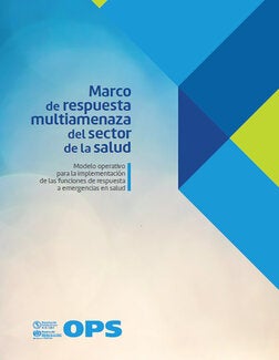
Health sector multi-hazard response framework
The main objective of the health sector’s Multi-Hazard Response Framework (MRM) is to improve countries’ capacity to manage emergency and disaster response more efficiently.
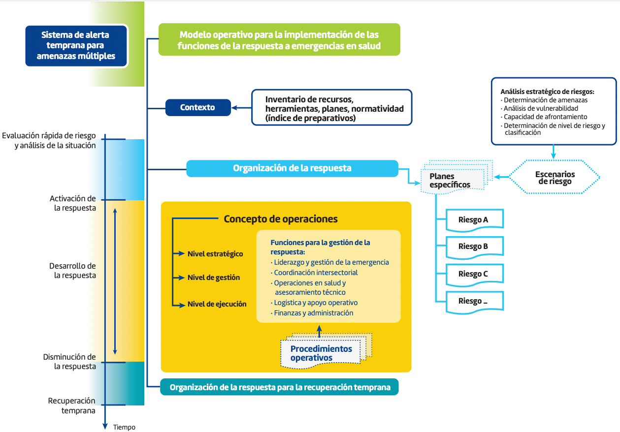
The MRM offers an operational model that allows it to identify response activities, taking into account all existing threats, and carries them out within the framework of the nation and based on the organization of the health sector.
The MRM is designed primarily for health authorities, emergency services managers and disaster risk management, guiding them in the process of updating and developing response plans.
Implementing the MRM will provide countries with adequate response planning from a multi-hazard approach.
MRM operational model for implementing the functions of responding to a health emergency
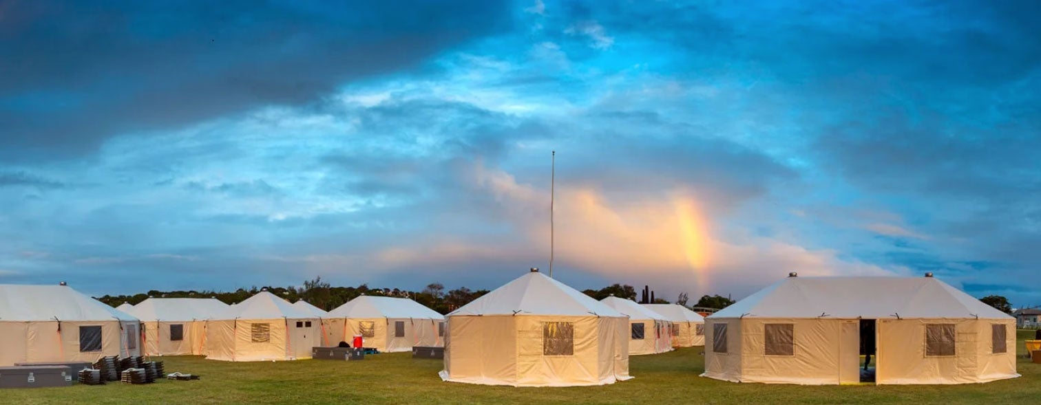
From the Risk, Emergency and Disaster Management Unit in coordination with the Vice Ministry of Civil Defense, ministerial programs and the
OPS/OMS BoliviaWe are strengthening emergency and disaster preparedness in the
#Health sector .Through the workshop for the application of the “Strategic Health Risk Assessment Tool (STAR)” and the Health Emergency and Disaster Preparedness Index (IPED), which allows the identification and prioritization of the main threats in the country with a multi-hazard approach.This work allows us to anticipate different
#AdverseEvents , improve health contingency plans and strengthen the response to emergencies and disasters, always with the commitment to protect the health of the population.


From the Risk, Emergency and Disaster Management Unit in coordination with the Vice Ministry of Civil Defense, ministerial programs and the
OPS/OMS BoliviaWe are strengthening emergency and disaster preparedness in the
#Health sector .Through the workshop for the application of the “Strategic Health Risk Assessment Tool (STAR)” and the Health Emergency and Disaster Preparedness Index (IPED), which allows the identification and prioritization of the main threats in the country with a multi-hazard approach.This work allows us to anticipate different
#AdverseEvents , improve health contingency plans and strengthen the response to emergencies and disasters, always with the commitment to protect the health of the population.
Vice Ministry of Civil Defense
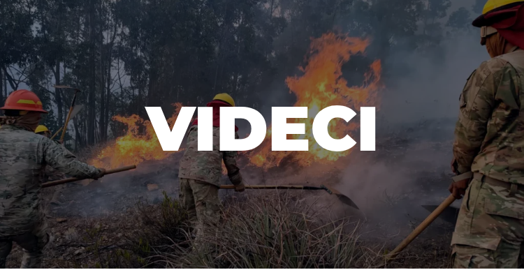
Goals:
Plan, coordinate and execute risk reduction actions, proposing risk management policies and strategies.
Functions :
To propose policies and strategies for risk management, for their incorporation into the National Planning System and the Public Investment Program.
Plan and coordinate actions aimed at the prevention and reduction of risks in coordination with departmental, regional, municipal bodies and indigenous peasant communities, as well as with public and private, national and international entities.
Plan and execute actions for preparation, alert, response, rehabilitation and reconstruction in case of emergencies and natural, technological and anthropogenic disasters in coordination with departmental, regional, municipal entities and indigenous peasant peoples, as well as with public and private, national and international entities.
Systematize and manage information on risk reduction and emergency and disaster response.
To serve as and direct the Technical Secretariat of the National Council for the Reduction and Attention to Disasters and Emergencies – CONARADE.
To coordinate with the Ministries of Economy and Public Finance and Development Planning the channeling of technical and financial cooperation, for the development of civil defense programs and projects in emergency and disaster situations.
To fulfill the powers and functions established in Title II Chapter IV, article 15 of Supreme Decree No. 29894.
Contact
Sopocachi. Av. 20 de Octubre, esq. Pedro Salazar No. 2502
Directions: View all directions
Telephone: (+591-2) 2432525 – 2610400
Freephone:
Email: gespejos@mindef.gob.bo