Climate risk and vulnerabilities of Tonga
Polished final version
Tonga is highly exposed and vulnerable to climate change and multi-hazard risks due to its small-island geography, dispersed outer islands, low-lying coastal settlements, active seismic and volcanic setting, fragile freshwater systems, and dependence on agriculture, fisheries, tourism, transport links, and coastal ecosystems. The country faces major risks from tropical cyclones, storm surge, coastal flooding, sea-level rise, coastal erosion, saltwater intrusion, drought, water insecurity, extreme rainfall, earthquakes, tsunamis, volcanic eruptions, ashfall, coral reef degradation, fisheries decline, agricultural losses, infrastructure damage, and climate-sensitive health impacts. Climate change is expected to intensify these vulnerabilities through rising temperatures, rising seas, stronger coastal inundation, changing rainfall patterns, drought stress, groundwater salinization, ecosystem degradation, and increasing pressure on food security, water security, public health, infrastructure, livelihoods, and vulnerable island communities. Strengthening multi-hazard early warning systems, impact-based forecasting, cyclone preparedness, coastal protection, tsunami and volcanic early warning, resilient water systems, climate-resilient agriculture, fisheries and reef resilience, disaster risk financing, and locally led island adaptation is essential to reduce losses and protect Tonga’s development gains.
Tonga is highly vulnerable to climate change and multi-hazard risks because of its small-island geography, dispersed island groups, low-lying coastal settlements, exposure to tropical cyclones, active seismic and volcanic setting, limited freshwater resources, and dependence on climate-sensitive agriculture, fisheries, tourism, transport links, and coastal ecosystems. Tonga is located in the cyclone-prone South Pacific and the Pacific Ring of Fire, making it exposed to tropical cyclones, storm surge, coastal flooding, sea-level rise, drought, earthquakes, tsunamis, volcanic eruptions, ashfall, extreme rainfall, floods, landslides, coral reef degradation, and climate-sensitive health risks.
1. Multi-hazard exposure
Tonga’s risk profile combines hydrometeorological, coastal, geophysical, volcanic, and ecosystem-related hazards. Tropical cyclones bring destructive winds, storm surge, coastal flooding, heavy rainfall, crop losses, water contamination, and infrastructure damage. Earthquakes, tsunamis, and volcanic eruptions add a high-impact geophysical risk layer. GFDRR estimates that Tonga faces average annual losses of about US$15.5 million from earthquakes and tropical cyclones, with a 50% chance over 50 years of losses exceeding US$175 million and casualties above 440 people. (GFDRR)
Tonga’s exposure is geographically differentiated. Tongatapu, where the capital Nukuʻalofa and many national assets are located, is highly exposed to storm surge, coastal flooding, tsunami risk, sea-level rise, and infrastructure disruption. Haʻapai is highly exposed to cyclones, coastal flooding, drought, and tsunami impacts. Vavaʻu faces cyclone, coastal, marine ecosystem, and tourism risks. The Niuas and other outer islands face isolation, communication disruption, water shortages, limited health access, and delayed recovery after disasters.
2. Climate change as a development risk multiplier
Climate change is a major development risk for Tonga because it affects water security, food security, coastal settlements, agriculture, fisheries, tourism, health, transport, and public finance. The World Bank climate profile describes Tonga’s climate as tropical, with a wet season from November to April and a dry season from May to October, and highlights the risks associated with changing temperature, rainfall, sea level, and extreme events. (Climate Change Knowledge Portal)
Tonga’s Joint National Action Plan 2 on Climate Change and Disaster Risk Management 2018–2028 is the main integrated national framework for climate and disaster resilience. It sets out six policy objectives, 22 targets, and an implementation strategy toward the national vision of a Resilient Tonga by 2035. (Asia Pacific Energy Policy)
3. Tropical cyclone, storm surge, and coastal-flood vulnerability
Tropical cyclones are among Tonga’s most damaging hazards. Cyclones can destroy houses, damage schools and health facilities, disrupt ports and airports, contaminate water systems, damage crops, reduce tourism income, and cut transport and communication links between islands. Tonga is frequently affected by tropical cyclones with damaging winds, rainfall, and storm surge, especially during the cyclone season from around October to May. (GFDRR)
Tropical Cyclone Gita in 2018 showed the severity of cyclone impacts on Tonga’s housing, public infrastructure, agriculture, transport, utilities, and tourism sectors. Tonga’s post-disaster assessment notes that the country is exposed to frequent severe weather and that the effects of natural hazards are far-reaching across social infrastructure, housing, agriculture, transport, public utilities, and tourism.
4. Earthquake, tsunami, volcanic eruption, and ashfall vulnerability
Tonga’s geophysical risk is exceptionally important because the country lies along the Pacific Ring of Fire. Earthquakes can damage buildings, roads, schools, hospitals, water systems, ports, power infrastructure, and communications. They can also trigger tsunamis that give coastal communities very limited response time. The 2009 magnitude 8.1 offshore earthquake generated a tsunami that killed nine people and destroyed more than half the houses on Niuatoputapu. (GFDRR)
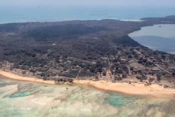
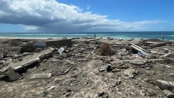
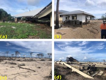
The 2022 Hunga Tonga–Hunga Haʻapai volcanic eruption, tsunami, and ashfall demonstrated Tonga’s exposure to compound geophysical disasters. A World Bank assessment estimated physical damages at US$90.4 million, equivalent to about 18.5% of GDP; around 85,000 people were affected, and damage included residential and non-residential buildings, infrastructure, agriculture, fisheries, tourism assets, water supply, ports, roads, power systems, and the submarine cable. (World Bank)
5. Sea-level rise, coastal erosion, and saltwater intrusion
Sea-level rise is one of Tonga’s most strategic long-term climate threats. Low-lying coastal settlements, roads, schools, health facilities, churches, cemeteries, water systems, ports, tourism assets, and food gardens are exposed to storm surge, coastal erosion, wave overtopping, king tides, and saltwater intrusion. Tonga’s Second NDC reports that sea levels in Tongan waters are projected to rise under all emissions scenarios, with estimates ranging from 7–27 cm by 2030 and 11–88 cm by 2090. (climatechange.gov.to)
The World Bank climate profile reports that under a 0.3 m sea-level rise, about 27.9 km², or 11% of Tongatapu Island, and around 23,470 people, or 37% of Tongatapu’s population, would be at risk. This makes coastal adaptation especially urgent for national infrastructure, settlement planning, water security, and long-term land-use decisions. (Climate Change Knowledge Portal)
6. Water security and drought vulnerability
Freshwater security is a critical vulnerability for Tonga. Many communities depend on rainwater harvesting and fragile freshwater lenses, while drought reduces stored water and sea-level rise increases the risk of saltwater intrusion into groundwater. UNDP notes that droughts occur during the dry season and can deplete potable water, while groundwater supplies are vulnerable to saltwater intrusion as sea levels rise. (adaptation-undp.org)
Water insecurity affects drinking water, sanitation, schools, health facilities, agriculture, livestock, household hygiene, and emergency response. During volcanic ashfall, cyclones, droughts, or storm surge events, rainwater tanks, roof catchments, groundwater, and local distribution systems can be contaminated or damaged, increasing the need for emergency desalination, water trucking, household storage, and WASH preparedness.
7. Agriculture, fisheries, and livelihood vulnerability
Tonga’s food systems are exposed to cyclones, drought, saltwater intrusion, ashfall, flooding, pests, heat stress, and coastal ecosystem degradation. Tonga’s 2024 Technology Needs Assessment notes that sea-level rise may reduce agricultural land and threaten livelihoods and food security, while recorded droughts in 1983, 1998, 2006, and 2015 affected crops such as squash, yams, sweet potatoes, root crops, and coconuts. (UNFCCC)
Fisheries and marine ecosystems are also highly climate-sensitive. The Green Climate Fund notes that climate change poses severe threats to Tonga’s coastal fisheries and aquaculture through more severe extreme weather, rising sea levels, increasing water temperature, and ocean acidification, with expected negative effects on coastal habitats, fish, invertebrates, food security, livelihoods, and the national economy. (Green Climate Fund)
| Sub-sector | Main climate and hazard risks |
|---|---|
| Root crops and food gardens | Cyclones, drought, saltwater intrusion, ashfall, flooding, pests, soil degradation |
| Coconut and tree crops | Cyclone wind damage, drought stress, salt spray, coastal erosion |
| Livestock | Water shortages, heat stress, feed scarcity, cyclone damage |
| Coastal fisheries | Coral reef decline, ocean warming, acidification, storm damage, changing fish distribution |
| Tourism livelihoods | Coastal erosion, reef degradation, cyclone damage, water shortages, infrastructure disruption |
| Outer-island livelihoods | Isolation, water stress, market disruption, limited emergency supplies and recovery finance |
8. Infrastructure, housing, and service-delivery vulnerability
Tonga’s infrastructure is highly exposed because key assets are located in narrow coastal zones and dispersed across islands. Exposed systems include housing, schools, health facilities, roads, causeways, ports, wharves, airports, power systems, telecommunications, water supply, sanitation systems, and coastal protection structures. The 2022 volcanic eruption and tsunami damaged around 600 structures, including at least 300 residential buildings, while infrastructure damage included roads, causeways, power supply, ports, marine assets, water supply infrastructure, and the submarine cable. (World Bank)
Infrastructure vulnerability is amplified by Tonga’s dispersed geography. Damage to ports, wharves, airstrips, or communication cables can delay relief, disrupt inter-island supply chains, isolate communities, and increase recovery costs. For outer islands, small disruptions can become major service-delivery crises if transport, water, power, health, or communication systems are affected simultaneously.
9. Health and social vulnerability
Climate change can worsen health risks through heat stress, unsafe water, diarrhoeal disease, vector-borne disease, malnutrition, injuries during cyclones and tsunamis, respiratory impacts from ashfall, mental stress, and disruption to health services. The 2022 eruption and tsunami caused major disruption to water supplies through ash contamination, showing how volcanic, coastal, and WASH risks can combine in a single event. (World Bank)
The most vulnerable groups include outer-island communities, coastal households, subsistence farmers, fishers, women-headed households, children, older persons, people with disabilities, people with chronic illnesses, low-income households, and communities living in tsunami-, cyclone-, flood-, drought-, or erosion-prone areas. Vulnerability is highest where exposure overlaps with weak housing, limited water storage, low savings, limited insurance, poor transport access, and limited last-mile early warning.
10. Sector-specific vulnerability summary
| Sector | Main climate and multi-hazard risks |
|---|---|
| Coastal settlements | Sea-level rise, storm surge, coastal flooding, erosion, tsunami exposure, saltwater intrusion |
| Water and WASH | Drought, ashfall contamination, saline intrusion, damaged rainwater tanks, limited storage |
| Agriculture and food security | Cyclones, drought, ashfall, saltwater intrusion, pests, root-crop and tree-crop losses |
| Fisheries and marine ecosystems | Coral bleaching, ocean warming, acidification, storm damage, reef and lagoon degradation |
| Housing and infrastructure | Cyclone winds, tsunami damage, coastal flooding, ashfall, road and port disruption |
| Health | Heat stress, waterborne disease, respiratory impacts from ash, malnutrition, disaster injuries |
| Tourism | Coastal erosion, reef damage, cyclone and tsunami impacts, water shortages, business disruption |
| Education and public services | School damage, service interruption, transport isolation, evacuation and shelter constraints |
| Geophysical risk | Earthquakes, tsunamis, volcanic eruptions, ashfall, submarine-cable and port disruption |
11. Priority resilience needs
Tonga’s resilience agenda should prioritize multi-hazard early warning systems, impact-based forecasting, cyclone preparedness, tsunami and volcanic early warning, coastal inundation monitoring, drought preparedness, water security, resilient housing, climate-resilient agriculture, fisheries and reef resilience, safe public infrastructure, disaster risk financing, and locally led island adaptation.
| Priority area | Key actions |
|---|---|
| Early warning and anticipatory action | Impact-based warnings for cyclones, storm surge, coastal flooding, drought, tsunami, volcanic ashfall, heat and health risks |
| Cyclone and coastal resilience | Cyclone-safe housing, coastal-risk mapping, nature-based buffers, drainage improvement, evacuation shelters and routes |
| Tsunami and volcanic preparedness | Tsunami evacuation planning, volcano monitoring, ashfall protocols, public drills, emergency communications |
| Water security | Rainwater harvesting, household tanks, desalination backup, groundwater protection, salinity monitoring, drought contingency plans |
| Climate-resilient agriculture | Salt-, drought-, cyclone- and ash-tolerant crops, seed banks, agroforestry, food storage, pest monitoring |
| Fisheries and reef resilience | Marine protected areas, reef restoration, sustainable fisheries management, aquaculture resilience, safe harbour support |
| Infrastructure resilience | Climate- and seismic-resilient roads, schools, clinics, ports, power systems, water systems and communications |
| Risk financing and recovery | Contingency finance, insurance, forecast-based financing, resilient reconstruction, local recovery funds |
National Disaster Risk Management Office (NDRMO) nemotonga.gov.to
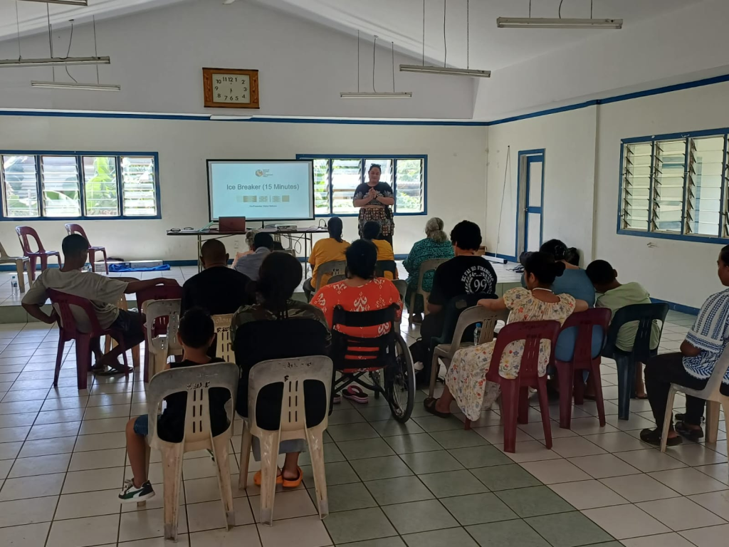
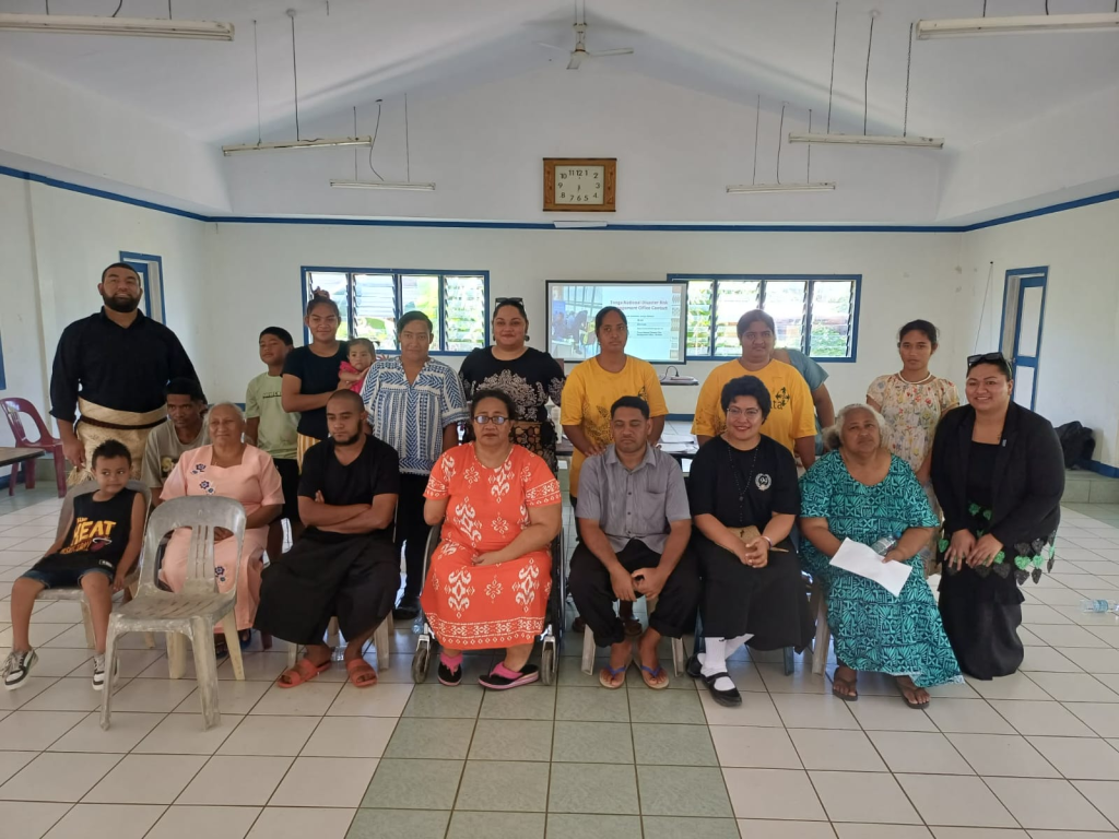
The National Disaster Risk Management Office (NDRMO) is responsible for coordinating disaster risk management and emergency response activities across the Kingdom of Tonga. NEMO works to enhance the country’s resilience to natural disasters through preparedness, response, recovery, and mitigation efforts. It collaborates with various government agencies, non-governmental organizations, and international partners to ensure effective disaster management. It also focuses on community awareness and education programs to build a culture of safety and preparedness among the Tongan population.
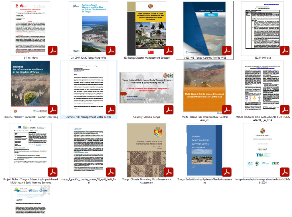
Download useful Documents on Tonga
https://drive.google.com/drive/folders/1VeR4zs9KltLKIRR8HA684AFhGmAohm0E?usp=sharing