MNEWC provides PDNA Methodology, Guidelines, and Assessment Process for the Global South Countries
- We conduct an assessment of the availability and application of nationally approved PDNA methodologies, guidelines, templates, sector tools, sector-level technical expertise, data standards, and reporting formats.
- Assess the alignment of national methodologies with internationally recognized approaches for damage, loss, human impact, needs, recovery, and reconstruction assessment.
- Review the full PDNA process, including:
- Prepare sector level L&Ds /Imapct level data collection tools, methodology, guidelines, and process
- Conduct training, develop partnership activation and institutional mobilization;
- Assessment scoping and planning;
- Formation of sector teams;
- Baseline data compilation tools/process/repositories;
- Field data collection( ICT /AI/UAV tools);
- Damage and loss estimation tools/process;
- Human-impact and needs assessment tools/process;
- Recovery-needs identification;
- Framework, methodologies for the UN Cluster’s anchoring with national sectors
- Build Back Better analysis;
- Sector prioritization;
- Cost estimation;
- Validation and quality assurance;
- Report preparation;
- Government endorsement;
- Recovery-framework development; and
- Monitoring of recovery implementation.
- Assess the availability and quality of baseline datasets, administrative records, census data, sector inventories, asset databases, land-use data, infrastructure data, household information, market information, and historical disaster-loss databases.
Develop ICT, GIS, Remote Sensing, and UAV Capacity for PDNA
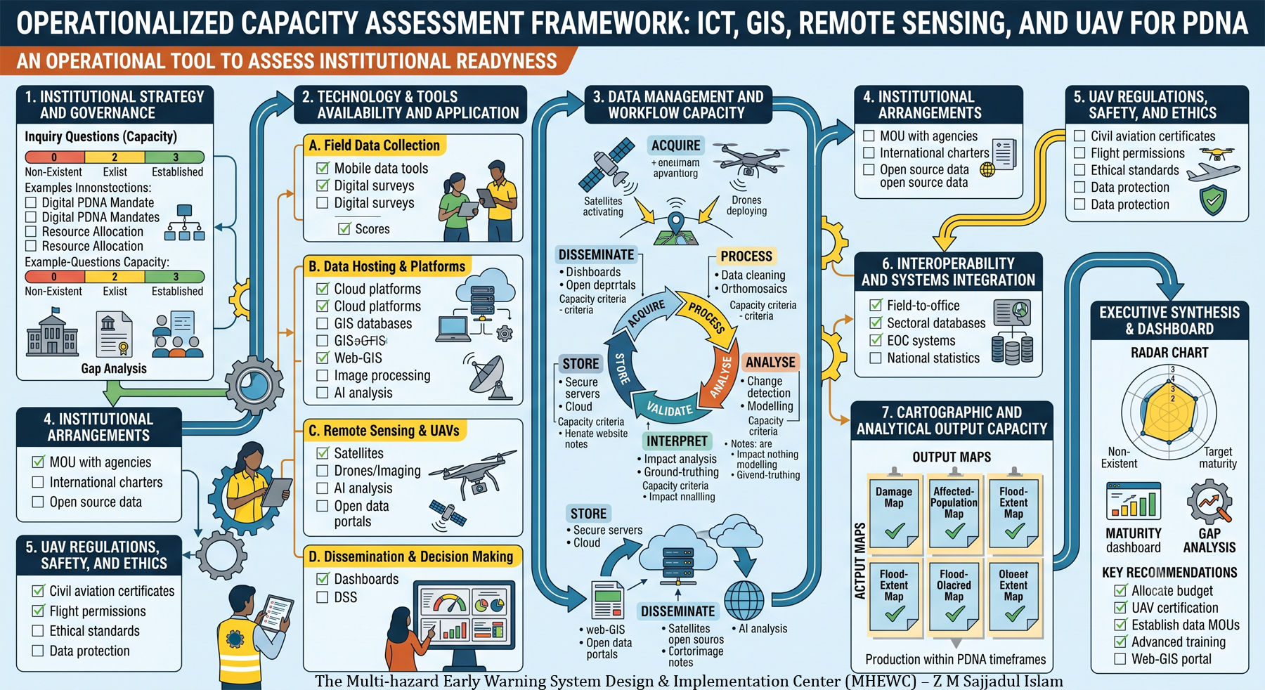
- Assess institutional capacity to use digital technologies for rapid and comprehensive post-disaster assessment.
- Review the availability and application of:
- Mobile data-collection tools;
- Digital survey applications;
- Cloud-based assessment platforms;
- GIS databases;
- Web-GIS portals;
- Remote-sensing imagery;
- Satellite data;
- Unmanned aerial vehicles;
- Drone-based imaging;
- Global positioning systems;
- Digital elevation models;
- Image-processing software;
- Damage-classification tools;
- Artificial intelligence-assisted analysis;
- Digital dashboards, and
- Geospatial & Database-driven Decision-support systems(DSS).
- Assess capacity to acquire, process, analyze, interpret, validate, store, and disseminate geospatial and remote-sensing data.
- Review institutional arrangements for obtaining pre-disaster and post-disaster imagery, including access to satellite imagery, drone operations, aerial surveys, open-source geospatial data, and commercial data providers.
- Assess compliance with UAV regulations, flight permissions, operational safety procedures, data-protection requirements, and ethical standards.
- Review interoperability between field-assessment tools, sector databases, EOC systems, GIS platforms, national statistics systems, and recovery-planning systems.
- Assess capacity to produce:
- Damage maps;
- Affected-population maps;
- Infrastructure-impact maps;
- Agricultural damage maps;
- Flood-extent maps;
- Landslide inventories;
- Building-damage classifications;
- Accessibility and logistics maps;
- Recovery-priority maps; and
- Spatial recovery-investment plans.
Please contact MHEWC at : zmsajjad@gmail, WhatsApp : +88 01711 979179