Climate risk and vulnerabilities of Kiribati
Kiribati is highly exposed and vulnerable to climate change and multi-hazard risks due to its low-lying atoll geography, fragile freshwater lenses, narrow coastal settlement zones, limited agricultural land, high dependence on rainwater and groundwater, reliance on fisheries and imported food, and concentration of people, infrastructure, culture, and public services close to the ocean. The country faces severe risks from sea-level rise, king tides, wave overtopping, storm surge, coastal flooding, coastal erosion, saltwater intrusion, drought, water insecurity, extreme heat, coral reef degradation, fisheries decline, food insecurity, public-health impacts, infrastructure disruption, cultural loss, and long-term habitability threats. Climate change is expected to intensify these vulnerabilities through rising seas, more frequent inundation, saline contamination of water and soils, hotter conditions, drought stress, ecosystem degradation, and growing pressure on water security, food security, public health, livelihoods, infrastructure, culture, sovereignty, and vulnerable atoll communities. Strengthening coastal protection, land raising, climate-resilient water systems, drought preparedness, multi-hazard early warning, impact-based forecasting, resilient housing and public infrastructure, sanitation resilience, fisheries and reef conservation, disaster risk financing, and long-term sovereignty-sensitive adaptation planning is essential to reduce losses and protect Kiribati’s people, identity, and development gains.
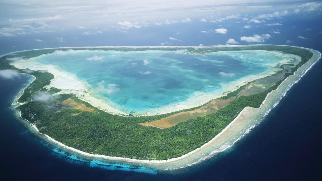
Kiribati is one of the world’s most climate-vulnerable countries because it is a low-lying atoll and reef-island state with very limited land elevation, fragile freshwater lenses, narrow settlement areas, high dependence on rainwater and groundwater, strong reliance on fisheries and imported food, and critical exposure to sea-level rise, king tides, coastal flooding, wave overtopping, saltwater intrusion, drought, storm surge, heat stress, coral reef degradation, food insecurity, water insecurity, and long-term habitability risks. The World Bank climate profile notes that Kiribati’s coral atolls are very low-lying, with maximum elevations of only about 3–4 metres above sea level, making coastal inundation and sea-level rise a central national risk. (Climate Change Knowledge Portal).

1. Multi-hazard exposure
Kiribati’s main hazards include sea-level rise, coastal flooding, storm surge, wave overtopping, king tides, coastal erosion, saltwater intrusion, drought, extreme heat, intense rainfall, freshwater contamination, coral bleaching, marine ecosystem degradation, and climate-sensitive health risks. Most people, public services, roads, housing, schools, clinics, churches, government buildings, water systems, airstrips, and community infrastructure are located close to the ocean or lagoon, leaving little safe space for retreat within many islands. The World Bank states that most of Kiribati’s population and infrastructure are located along coastal areas directly exposed to storm surges, coastal erosion, and inundation. (World Bank)
Kiribati’s exposure is especially high in South Tarawa, where population density, infrastructure concentration, groundwater pressure, sanitation stress, and coastal erosion combine to create severe compound risk. Outer islands face different but equally serious risks: weaker service access, limited emergency supplies, fragile rainwater systems, transport isolation, and high dependence on local food systems and marine resources.
2. Climate change as an existential development risk
For Kiribati, climate change is not only an environmental concern; it is an existential development, cultural, legal, and sovereignty issue. Sea-level rise threatens land, water, housing, health, food systems, public infrastructure, cultural heritage, and the long-term viability of atoll settlement. The World Bank’s 2024 research on Pacific atoll countries warns that sea-level rise of up to 0.5 metres by 2070–2110 could submerge 50–80% of major urban areas in highly vulnerable atoll countries, with serious implications for water access, food security, and economic stability. (World Bank)
Recent World Bank analysis estimated that physical adaptation to sea-level rise could cost around US$3.7 billion for Kiribati, excluding additional adaptation costs in health, education, energy, and water systems. This demonstrates the enormous financing gap faced by low-lying atoll states. (Reuters)
3. Sea-level rise, coastal flooding, and land-loss vulnerability
Sea-level rise is Kiribati’s most strategic long-term hazard. Rising seas increase king-tide flooding, wave overtopping, shoreline erosion, groundwater salinization, soil salinity, septic-system failure, damage to roads and housing, and loss of usable land. Kiribati’s climate change policy warns that projected sea-level rise could cause permanent shoreline retreat and inundation affecting much of the coastal zone. (President Taneti Maamau)
The impacts are already visible in some communities. IMF analysis notes that sea-level rise, erosion, and salinization have already contributed to forced relocation in Tebunginako village on Abaiang, where conditions became uninhabitable. (IMF eLibrary) This type of localized relocation illustrates a wider national challenge: adaptation must protect not only physical assets, but also land rights, cultural identity, gravesites, community cohesion, and self-determination.
4. Water security, drought, and saltwater intrusion vulnerability
Water security is one of Kiribati’s most critical vulnerabilities. Atoll freshwater systems depend heavily on rainwater harvesting and shallow freshwater lenses, both of which are highly sensitive to drought, sea-level rise, storm surge, king tides, and saltwater intrusion. The IMF notes that freshwater lenses are vulnerable to saltwater intrusion during storm and king-tide events, and that overwash can undermine soil fertility and food security. (IMF eLibrary)
Drought can rapidly create drinking-water shortages, hygiene problems, sanitation stress, school and clinic disruption, and increased disease risk. The Kiribati Adaptation Program has therefore focused on safe drinking water, protection of water resources, and coastal infrastructure resilience. (World Bank)
5. Coastal infrastructure, settlements, and service-delivery vulnerability
Kiribati’s infrastructure is highly exposed because most assets are located on narrow coastal strips. Key exposed systems include roads, causeways, schools, clinics, hospitals, churches, government buildings, ports, airstrips, water tanks, sanitation systems, power systems, telecommunications, seawalls, and community shelters.
Coastal flooding can damage several systems at once: roads become impassable, wells become saline, septic systems fail, schools and health facilities are disrupted, and households lose both shelter and food gardens. In South Tarawa, where land is scarce and population density is high, even small losses of land or water quality can create major development and public-health consequences.
6. Food security, agriculture, and fisheries vulnerability
Food security is highly climate-sensitive because Kiribati has limited agricultural land, poor atoll soils, saline groundwater risks, drought exposure, and high dependence on imported food. Local crops such as coconut, breadfruit, pandanus, taro, banana, and home-garden vegetables are vulnerable to saltwater intrusion, drought, storm damage, heat stress, pests, and soil infertility.
Fisheries are central to food security, livelihoods, revenue, culture, and nutrition. However, ocean warming, coral bleaching, ocean acidification, reef degradation, storm damage, and shifting fish distribution can reduce coastal fisheries productivity and weaken natural shoreline protection. UNDP-supported work in Kiribati highlights the need to diversify food options and conserve natural resources to strengthen food security and community resilience. (UNDP Adaptation)
| Sub-sector | Main climate and hazard risks |
|---|---|
| Household gardens | Saltwater intrusion, drought, heat stress, poor soils, wave overwash |
| Traditional crops | Coastal flooding, salinity, storm damage, pests, water stress |
| Coastal fisheries | Coral bleaching, reef degradation, ocean warming, storm damage |
| Offshore fisheries | Changing fish distribution, ocean-temperature shifts, marine ecosystem stress |
| Food security | Import dependence, crop losses, shipping disruption, price shocks, nutrition stress |
| Outer-island livelihoods | Water shortages, transport isolation, weak market access, limited recovery support |
7. Health and social vulnerability
Climate change can worsen health risks through unsafe water, diarrhoeal disease, heat stress, malnutrition, respiratory stress, vector-sensitive disease risks, sanitation failure, overcrowding, injury during flooding, and psychosocial stress linked to displacement or land loss. Sea-level rise can also affect health indirectly through saltwater contamination, food insecurity, housing stress, and reduced access to services. Recent public-health analysis on sea-level rise emphasizes risks such as contaminated water supplies, waterborne disease, overwhelmed sanitation systems, malnutrition, displacement stress, and threats to coastal health infrastructure. (The Guardian)
The most vulnerable groups include children, older persons, people with disabilities, women-headed households, low-income households, households with limited water storage, communities living along eroding shorelines, outer-island communities, fishers, small farmers, and people dependent on continuous health services. Vulnerability is highest where exposure overlaps with poverty, weak housing, water insecurity, poor sanitation, limited savings, and restricted evacuation or relocation options.
8. Relocation, culture, identity, and sovereignty risks
Kiribati’s climate vulnerability includes profound social, cultural, legal, and sovereignty dimensions. Land is tied to kinship, identity, customary rights, burial sites, churches, community life, and national statehood. Therefore, relocation is not simply a technical land-use decision; it is a major cultural and political issue.
International reporting has highlighted that Kiribati and other low-lying Pacific states are seeking stronger global recognition of the legal and social consequences of sea-level rise, including questions of mobility, sovereignty, maritime zones, and support for adaptation finance. (The Guardian) Long-term adaptation therefore needs to combine coastal protection, land raising, water security, livelihood protection, migration-with-dignity pathways, and legal protection of national identity and maritime rights.
9. Sector-specific vulnerability summary
| Sector | Main climate and multi-hazard risks |
|---|---|
| Coastal settlements | Sea-level rise, king tides, wave overtopping, storm surge, coastal erosion, land loss |
| Water resources | Drought, groundwater salinization, limited storage, flood contamination, emergency water dependence |
| Food security | Saline soils, crop losses, import dependence, shipping disruption, nutrition stress |
| Fisheries and reefs | Coral bleaching, reef degradation, ocean warming, acidification, shifting fish stocks |
| Health | Heat stress, diarrhoeal disease, waterborne disease, malnutrition, mental stress, sanitation failure |
| Infrastructure | Road flooding, airstrip and port exposure, seawall damage, water and sanitation disruption |
| Education and public services | School flooding, water shortages, shelter constraints, service interruption |
| Culture and heritage | Cemetery damage, loss of ancestral land, relocation pressure, erosion of cultural sites |
| Sovereignty and statehood | Long-term habitability risks, maritime-zone concerns, displacement and self-determination challenges |
10. Priority resilience needs
Kiribati’s resilience agenda should prioritize coastal protection, land raising, water security, drought preparedness, groundwater protection, sanitation resilience, multi-hazard early warning, impact-based forecasting, climate-resilient housing, food security, fisheries and reef conservation, health-system adaptation, disaster risk financing, and long-term sovereignty-sensitive adaptation planning.
Kiribati’s National Adaptation Plan is designed as an implementation tool for climate change and disaster-risk-management policies, strengthening national resilience efforts across key sectors. (UNFCCC) The government has also identified water, coastal zones, coastal infrastructure, and agriculture as among the most vulnerable sectors. (NAP Global Network)
| Priority area | Key actions |
|---|---|
| Early warning and anticipatory action | Impact-based alerts for king tides, coastal flooding, drought, heat, water shortages, storm surge, and health risks |
| Coastal resilience | Land raising, seawalls where appropriate, nature-based buffers, shoreline monitoring, safe land-use planning |
| Water security | Rainwater harvesting, household tanks, groundwater protection, desalination backup, drought contingency plans |
| Saltwater intrusion management | Salinity monitoring, freshwater-lens protection, sanitation upgrades, groundwater recharge protection |
| Climate-resilient infrastructure | Elevated roads, schools, clinics, water systems, sanitation systems, ports, airstrips, power, and telecoms |
| Food and fisheries resilience | Salt-tolerant crops, protected gardens, food storage, reef conservation, sustainable fisheries management |
| Health resilience | Heat-health planning, WASH resilience, disease surveillance, nutrition support, emergency medical continuity |
| Risk financing and governance | Climate finance access, contingency funds, insurance options, resilient recovery, community-led adaptation |
| Long-term habitability planning | Community-led relocation where unavoidable, cultural heritage protection, legal protection of maritime zones, dignified mobility options |
National Disaster Risk Management Council (NDRMC)
The National Disaster Risk Reduction and Management Centre (NDRRMC) under the aegis of the Ministry of Social Security, National Solidarity, and Environment and Sustainable Development (Environment and Sustainable Development Division) (MoSSESD)
The legislative framework for disaster risk management in Kiribati is found in the National Disaster Act 1993 and, to a lesser extent, Article 16 of the Constitution. The latter provides for a state of a public emergency to be declared by the Beretitenti on the advice of the Cabinet. Such declarations can only stay in place for 30 days without approval from the Maneaba. During this period, significant authority is exercised by the Beretitenti to introduce regulations and exercise extra constitutional authority “that is reasonably justifiable in the circumstances of any situation arising or existing during the period for the purpose of dealing with the situation”.
The National Disaster Act 1993 is the key legislative provision and provides for responsibility for response and recovery to lie with a Minister (currently the Beretitenti), acting under the advice of the National Disaster Council. The Act mandates and is complemented by the 2012 National Disaster Risk Management Plan.
The National Disaster Council (NDRMC) operates as the key executive body in the Kiribati model, comprising the chief executives (Secretaries) of all government departments in addition to the Kiribati Red Cross, the Director of the Kiribati Meteorological Office and the President of the Kiribati Association of NGOs. Outside of a disaster event, the NDRMC acts as an advisor to the responsible Minister and ensures that DRM policies are implemented by government and NGO agencies. The NDRMC also has a specific role in advising the Minister and Cabinet on declarations of emergency and providing advice on the need for external aid (and agreements to facilitate such aid).
Island Disaster Committees (IDC’s) are responsible for coordination of DRM planning in each of the three islands and generally perform the responsibilities of the NDRMC at an island level. In the event that communication with Tarawa is disrupted, the IDCs take on all the responsibilities of the NDRMC. A series of sub-committees are established under the NDRMP to plan for and manage specific elements of the disaster response and recovery.
The National Disaster Management Office (which sits within the Office of the Beretitenti) is responsible for promoting and implementing DRM policy (as directed by the NDRMC) as well as reviewing the NDRMP on an annual basis and acting as secretariat to the NDRMC.
In the event of a disaster the NDRMC retains its overall co-ordination role but management of the response passes to the Disaster Controller (currently designated as the Commissioner of Police) and an Emergency Operations Committee (established as a sub-committee of the NDMRC). This committee both responds to requests from the NDRMC (or Ministers) as to resource availability and determines “foreign resources requirements”.
Kiribati is a presidential republic operating a modified form of representative parliamentary democracy. The Kiribati constitution establishes a 43-member unicameral house of assembly (the Maneaba ni Maungatabu), 44 of whom are elected from 24 constituencies; namely 23 island councils in the Republic of Kiribati and one (1) Rabi Banaban Community in Fiji, except for the speaker who is elected by the members but is not a member. One member is elected by the Rabi Islands Council (based in Fiji) to represent the Banaban Community there, while another member is elected separately to represent the people of Banaba Island. The Attorney General no longer sits in the Maneaba ni Maungatabu as an ex-officio member but is substituted by the Minister of Justice.
Executive authority is held by the President (Beretitenti) who is both head of state and head of government. The Beretitenti is elected by universal suffrage from a shortlist of three or four candidates provided by the Maneaba ni Maungatabu from amongst its members. Once appointed, the Beretitenti appoints a cabinet of up to twelve members including a Kauomanni-Beretitenti (or Vice President) from the Maneaba ni Maungatabu. Although Kiribati has a number of political parties, their organisation is very loose. Local governments in Kiribati exhibit significant autonomy including in fields relating to DRM although in the event of an Emergency, the President can act directly, without reference to local authorities. Since 2010, this discretion has been limited to acting “in accordance with an action plan of the Council dealing with disaster and emergencies”, but the Disaster Risk Management & Climate Change (DRMCC) Act empowers the National Disaster Risk Management Council (NDRMC) to direct partner agency attention and resources to support the President’s discretion during emergencies.
The bulk of local governments are island councils (23) although Tarawa has three urban Councils. Island Councils in particular suffer from significant challenges around funding and capacity. For this reason, most functions outside Tarawa are provided by the national government, with local authorities merely administering the services. Alongside the democratic local government structure, traditional local authority still plays a prominent role. This is incorporated into the formal local government system through the male community elders (unimane) having a reserved (appointed) seat on local councils. Informally, the role of the unimane remains influential in local decision making.