Uganda’s Climate Risk and Vulnerability
Uganda is highly vulnerable to climate change and multi-hazard risks due to its dependence on rain-fed agriculture, rapid population growth, ecosystem degradation, limited irrigation coverage, high rural poverty, expanding informal settlements, and exposure to recurrent floods, droughts, landslides and climate-sensitive disease outbreaks.
GFDRR identifies Uganda as regularly affected by droughts, earthquakes, floods, landslides and volcanoes, with floods presenting the largest disaster risk. Floods affect nearly 50,000 people annually, while droughts affected around 2.4 million people between 2004 and 2013. The 2010-2011 drought caused estimated losses of US$1.2 billion, equivalent to about 7.5% of Uganda’s 2010 GDP. GFDRR
1. Climate Risk Context
Uganda is already experiencing erratic rainfall, prolonged dry spells, droughts, floods, rising temperatures, shifting farming seasons, and increased pest and disease incidence. The National Adaptation Plan for the Agriculture Sector notes that average temperatures may rise by 1-3°C by 2050, while rainfall patterns are expected to become increasingly erratic. Uganda NAP-Ag
Uganda’s updated NDC states that climate change is affecting physical infrastructure, food security, water resources, agriculture, energy, health and ecosystems, and warns that the cost of adaptation inaction could reach US$3.2-5.9 billion annually within a decade. Uganda Updated NDC
2. Major Climate and Hazard Risks
| Hazard | Risk pathway | Vulnerable areas / groups |
|---|---|---|
| Floods and flash floods | Crop loss, road damage, displacement, WASH contamination, disease outbreaks | Eastern Uganda, Lake Kyoga basin, Lake Victoria basin, Kampala, low-lying districts |
| Landslides and mudslides | Loss of life, burial of homes/farms, road blockage, displacement | Mt. Elgon, Bududa, Manafwa, Sironko, Bulambuli, Rwenzori slopes |
| Drought and dry spells | Crop failure, pasture loss, livestock stress, water scarcity, food insecurity | Karamoja, cattle corridor, northern and eastern Uganda |
| Urban flooding | Drainage overflow, damage to informal settlements, road disruption, disease risk | Kampala, Jinja, Mbale, Gulu, Mbarara |
| Heat stress | Health risks, labour productivity loss, crop/livestock stress | Lowland districts, urban centres, outdoor workers |
| Climate-sensitive disease | Malaria, cholera, diarrhoeal disease, malnutrition | Flood-prone districts, drought-prone districts, refugee settlements |
| Water scarcity | Unsafe water use, long water-collection distances, conflict over water | Karamoja, cattle corridor, rural dryland areas |
| Ecosystem degradation | Soil erosion, reduced flood buffering, water-quality decline | Wetlands, forests, watersheds, lakeshores |
3. Exposure Assessment
Uganda is exposed to both rapid-onset hazards and slow-onset climate stresses.
Rapid-onset hazards include:
floods;
flash floods;
landslides;
mudslides;
storms;
lightning;
disease outbreaks;
urban drainage failures.
Slow-onset climate stresses include:
rising temperatures;
prolonged dry spells;
drought;
soil degradation;
water scarcity;
wetland loss;
forest degradation;
changing rainfall seasons;
declining ecosystem resilience.
The most exposed geographic zones include Karamoja, the cattle corridor, Mt. Elgon, Rwenzori region, Lake Victoria basin, Lake Kyoga basin, Kampala metropolitan area, and refugee-hosting districts.
4. Sensitivity Assessment
Uganda’s sensitivity to climate shocks is high because livelihoods and national development depend strongly on climate-sensitive systems.
Agriculture and Food Security
Agriculture is Uganda’s most climate-sensitive sector. The agriculture NAP states that agriculture contributes about 21.9% of GDP, 85% of export earnings, and 68% of employment. More than 80% of Uganda’s rural population depends on subsistence agriculture, and 96% of farming parcels depend on rainfall, while only 1% use irrigation as the main water source. Uganda NAP-Ag
Key vulnerabilities include:
delayed rainfall onset and early rainfall cessation;
drought-related crop failure;
flood damage to crops and storage facilities;
livestock mortality and pasture stress;
increased pests and diseases;
reduced coffee, maize, beans, bananas, cassava and sorghum productivity;
food-price volatility and household food insecurity.
Water, WASH and Public Health
Climate change affects water availability, water quality and public health. Floods contaminate water sources and sanitation systems, while drought forces households to use unsafe or expensive water sources. Uganda’s WASH sector NAP highlights that women and children face increased burdens during droughts and floods, including longer water-collection distances, school absenteeism and protection risks. Uganda WASH NAP
Health risks include:
malaria expansion;
cholera outbreaks;
diarrhoeal disease;
malnutrition;
heat stress;
respiratory illness;
injuries from floods and landslides;
mental stress after displacement and livelihood loss.
Infrastructure and Settlements
Roads, bridges, schools, health centres, markets, water systems and housing are vulnerable to floods, erosion and landslides. Informal settlements in Kampala and other towns face high flood exposure due to poor drainage, settlement in wetlands, blocked channels and limited solid-waste management.
Ecosystems and Natural Resources
Wetlands, forests, watersheds and lakeshores are critical natural buffers. Their degradation increases flood risk, reduces water storage, worsens erosion and weakens biodiversity-based livelihoods. Wetland encroachment around urban areas, especially Kampala, directly increases pluvial flood risk.
5. Adaptive Capacity Assessment
Uganda has important policy and institutional foundations, including:
National Climate Change Policy;
updated NDC;
National Adaptation Plan process;
Agriculture Sector NAP;
WASH Sector NAP;
Health National Adaptation Plan;
disaster risk management institutions;
district-level planning structures.
However, adaptive capacity remains constrained by:
limited climate and hydrometeorological observation coverage;
weak last-mile early warning dissemination;
limited irrigation and water-storage infrastructure;
inadequate landslide monitoring;
insufficient district-level climate finance;
weak integration of risk data into local development planning;
high poverty and livelihood dependence on natural resources;
limited maintenance of drainage and flood-control infrastructure;
weak coordination between climate, disaster, agriculture, water, health and local government institutions.
6. Vulnerable Groups
The most vulnerable groups include:
smallholder farmers;
pastoralists and agro-pastoralists;
women and girls;
children;
elderly people;
persons with disabilities;
refugees and host communities;
informal-settlement residents;
mountain communities in landslide-prone areas;
fishing communities;
households dependent on wetlands, forests and rain-fed livelihoods.
7. Climate Risk Hotspots
| Hotspot | Main risks |
|---|---|
| Karamoja | Drought, food insecurity, livestock stress, water scarcity, malnutrition |
| Cattle corridor | Drought, pasture decline, livestock disease, water conflict |
| Mt. Elgon region | Landslides, mudslides, soil erosion, displacement |
| Rwenzori region | Landslides, floods, river overflow, slope instability |
| Kampala metropolitan area | Urban flooding, drainage failure, WASH contamination, informal settlement risk |
| Lake Victoria basin | Flooding, fisheries stress, shoreline erosion, water-quality risks |
| Lake Kyoga basin | Flooding, wetland degradation, displacement |
| Refugee-hosting districts | Water stress, ecosystem pressure, food insecurity, disease risk |
8. Priority Risk Reduction and Adaptation Measures
Strengthen impact-based flood early warning using rainfall forecasts, river gauges, drainage data, flood maps and exposed asset data.
Develop landslide early warning systems for Mt. Elgon and Rwenzori using rainfall thresholds, soil-moisture monitoring, slope mapping and community alert systems.
Expand drought early warning and anticipatory action linked to vegetation stress, water points, crop conditions, livestock health and food-security indicators.
Scale climate-smart agriculture through drought-tolerant crops, improved seed systems, agroforestry, soil-water conservation, irrigation and farmer climate advisories.
Restore wetlands and watersheds to reduce flooding, improve groundwater recharge and protect ecosystem services.
Strengthen WASH resilience through protected water points, water-quality monitoring, safe storage, flood-resilient sanitation and emergency WASH preparedness.
Improve urban flood management through drainage rehabilitation, solid-waste control, wetland protection and risk-sensitive land-use planning.
Integrate health and climate surveillance for malaria, cholera, diarrhoeal disease, malnutrition and heat stress.
Mainstream climate risk into district planning and budgeting so that local governments can plan, finance and monitor adaptation actions.
Develop a national geospatial risk repository and DSS integrating hazard maps, exposure data, vulnerability indicators, early-warning triggers, sector assets and loss-and-damage data.
Overall Assessment
Uganda’s climate vulnerability is driven by high exposure to floods, droughts and landslides; strong dependence on rain-fed agriculture; ecosystem degradation; WASH and health sensitivity; and limited local adaptive capacity. The country’s resilience pathway should prioritize impact-based multi-hazard early warning, climate-smart agriculture, drought preparedness, landslide monitoring, wetland restoration, resilient WASH systems, health-climate surveillance, district-level risk-informed planning and geospatial decision-support systems.
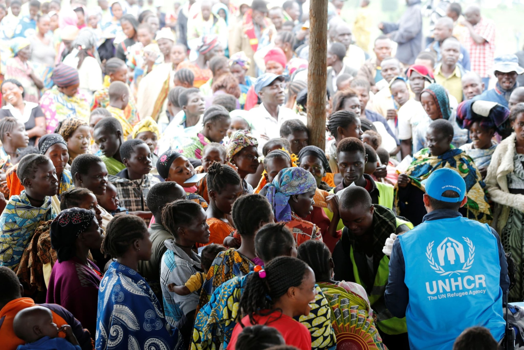
The Ministry of Disaster Preparedness and Refugees is a cabinet-level government ministry of Uganda. The ministry is responsible for the coordination of all refugee matters in the country. It is also responsible for national preparedness for disasters, including floods, landslides, earthquakes, droughts, and famine.
Office of the Prime Minister , Disaster Preparedness & Management
(https://opm.go.ug/disaster-preparedness-management/ )
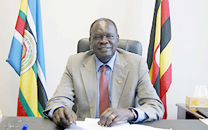
Hon. Eng. Hillary Onek
Minister for Relief, Disaster Preparedness and Refugees
Hon. Lillian Aber
Minister of State for Relief, Disaster Preparedness and Refugees
Mr. Davis Mwenyi
Commissioner/Disaster Preparedness & Management
Objective:
To strengthen capacities for mitigation, preparedness and response to natural and human induced disasters through:
- Enhancing the Country’s capacity to contain and minimize the effects of disasters;
- Addressing disaster vulnerabilities of the community and alleviating human suffering from disasters;
- Preventing, mitigating and preparing the country against disasters;
- Guiding government Disaster Preparedness and Management; and
- Maintaining a national warehouse for food and non-food items and procure relief.
Outputs
- Resilience of communities against disasters built;
- Timely response to disasters and provision food and non-food relief to disaster victims coordinated;
- Government and non-government actors coordinated in fulfilling their mandates towards disaster preparedness and management.
Key Activities
Effective preparedness and response to disasters
- Risk, Hazard, vulnerability profile and maps prepared.
- Disaster Risk Assessments conducted at District and community level
- Improved Preparedness for disasters by communities for resilience undertaken
- Participation in international workshops, meetings and conferences facilitated.
- Strong and functional Platform for DRR established
- High visibility of DRR activities in the country supported
- Strong and functional Platform for Peace Building & Conflict Prevention established
- High visibility of Peace Building and Conflict Prevention activities in the country supported
- Moroto Regional Disaster Coordination office established
- Vehicle maintenance, fuels, lubricants & oils procured
- Peace Policy completed
- Draft Disaster Bill developed
- NECOC activities supported
Relief to disaster victims
- Procure food and non-food items to Disaster victims
- Distribution and follow-up of the food and non-food items to Disaster victims
- DDMC, DDPC & Regional trainings for data collectors
- Contributing to the regional Disaster Management Centre of Excellence
Key Achievements
Effective preparedness and response to disasters
- Carried out Risk, Hazard, vulnerability and disaster assessment and mapping in 52 districts namely: Ntungamo, Kiruhura, Mbarara, Ibanda, Isingiro, Bushenyi, Kabarole, Katakwi, Kaberamaido, Amuria, Soroti, Ngora, Budaka, Bududa, Manafwa, Bulambuli, Sironko, Bukwo, Kween, Kapchorwa, Butaleja, Serere, Amuria, Katakwi, Ngora, Kumi, Moroto, Napak, Nakapiripirit, Amudat, Kotido, Kaabong, Ntoroko, Bundibugyo, Kaberamaido, Otuke, Dokolo, Lira, Apac, Amuru, Lamwo and Moyo.
- Carried out Risk assessment of threat of a perceived volcanic eruption in Abim district.
- Carried out El-Nino rapid assessment for 25 districts in Teso, Karamoja, Elgon, Rwenzori and West Nile sub regions.
- Carried out Assessments on boundary conflicts, lightening in Bukwo and Bushenyi respectively.
- Carried out Food Monitoring assessment in 7 districts of Karamoja.
- Participated in international trainings and meetings in Kenya, South Africa, Norway, Kenya and China. Topics range from GIS, Disaster Risk Financing and Oil spills contingency planning, INFORMED workshop and Youth innovation forum.
- Held 6 out of the planned 6 DRR Monthly meetings of the platform.
- Held 6 meetings of the Peace building and conflict prevention platform.
- Held 7 Regional Peace Consultative meetings in Elgon, Karamoja, Teso, Acholi, West Nile, Lango and Western Uganda.
- Produced a Draft Peace Policy.
- Held IDDR day celebrations in Bududa District after one week of visibility activities.
- Conducted International Peace day celebrations in Mbarara Municipal Council.
- Held 50 Sensitization meetings at subcounty level on the ELNino floods in Butaleja, Bududa, Bulambuli, Manafwa, Bukedea, Serere, Ngora, Kumi, Butaleja and Manafwa.
- Repaired the NECOC equipment for flood early warning system in Butaleja
- Disseminated NECOC Early Warning messages through FMs radios, TVs, Print media and sms. Handover of Flood Early Warning System by UCC to OPM.
- Carried out Regional trainings on Early Warning Systems and Climate Risk Management.
- Roll out Disaster Monitoring Systems in Kasese, Ntoroko, Bushenyi, Moroto, Amudat and Napak.
- Carried out Sensitization of communities on El-Nino in Bukedea, Serere, Ngora, Kumi, Butaleja and Manafwa.
- Attended the IGAD workshop, Youth innovation forum in China.
Relief to disaster victims
- Procured and Distributed 1400 bags of 100kg@ of maize grains; 5200 bags of 100kgs@ of maize flour and 3300 bags of 100kg@ of beans to famine victims in Karamoja and other parts of the country.
- Trained 600 UPDF officers on DRR and preparedness for El Nino.
- Trained 25 DRR platform members on Geo-Netcast system operations
- Carried out climate risk management training in 10 districts of Butaleja, Bududa, Bulambuli, Manafwa, Bukedea, Serere, Ngora, Kumi, Kween and Bukwo.
- Regional trainings on Early Warning Systems and Climate Risk Management in Jinja, Mukono, Kabale and Mbarara
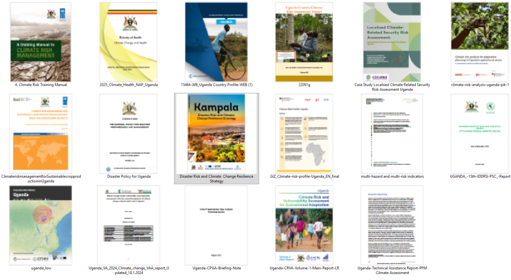
https://drive.google.com/drive/folders/1LmQT17dZJJwQoUYa6B-s_pekhUWt0JC6?usp=drive_link
Subject: Expression of Interest for a Working Opportunity with the Commissioner’s Office for Disaster Preparedness and Management
Dear Sir/Madam,
Greetings from the Multi-Hazard Early Warning System Design and Implementation Center (MHEWC).
MHEWC provides technical solutions to strengthen Disaster Risk Management (DRM) governance systems, multi-hazard early warning systems, risk-informed planning, and climate resilience. We would like to offer our technical support to the Commissioner’s Office for Disaster Preparedness and Management of Uganda in strengthening its institutional, technical, and operational capacities in the following areas:
- Upgrading the existing web portal into a geospatial, database-driven, and app-enabled Decision Support System (DSS) for disaster risk governance and early warning management.
- Conducting multi-hazard risk assessments, producing geospatial hazard and risk maps, and establishing a centralized repository and database management system for hazard, exposure, vulnerability, and risk information.
- Assessing existing monitoring and observation capacities and supporting the installation, enhancement, and integration of observation networks, including Automated Weather Stations (AWS), hybrid weather and hazard monitoring systems, real-time sensor data ingestion, ICT enablement, and data-driven hazard detection and warning mechanisms from national to last-mile levels.
- Designing and operationalizing an end-to-end Multi-Hazard Early Warning System (MHEWS), including weather nowcasting, hazard nowcasting, impact forecasting, forecast-based anticipatory early action, emergency preparedness and response management, forecast-based financing, Early Action Protocols, and DSS-supported Standing Orders on Disaster and Standard Operating Procedures.
- Supporting the design, implementation, and operationalization of a fully automated Hazard Detection, Monitoring, Prediction, Multi-Hazard and Disaster Emergency Operations Center (EOC).
- Reviewing and upgrading multi-hazard preparedness, response, and recovery plans across administrative levels and priority sectors.
- Conducting climate and multi-hazard risk and vulnerability assessments to support risk-informed policy, planning, and investment decisions.
- Developing a geospatial platform-driven Decision Support System for DRM governance, including GIS maps, databases, analytical tools, and local government and sector-level risk-informed planning and budgeting mechanisms.
- Providing additional technical assistance, advisory support, and capacity-building services as required.
We would welcome the opportunity to discuss the priorities and jointly explore a practical implementation roadmap for strengthening multi-hazard early warning, disaster preparedness, and risk governance systems.
We look forward to your kind response.
Sincerely,
Z M Sajjadul Islam
Director
Multi-Hazard Early Warning System Design and Implementation Center (MHEWC)
Web: www.mhewc.org
Phone & WhatsApp: +88 01711 979179
Email: zmsajjad@gmail.com , sajjad@mhewc.org