Climate risk and vulnerabilities of Vanuatu
Vanuatu is highly exposed and vulnerable to climate change and multi-hazard risks due to its dispersed volcanic island geography, active seismic and volcanic setting, low-lying coastal settlements, fragile freshwater systems, dependence on agriculture, fisheries and tourism, and high exposure of homes, roads, schools, health facilities, ports, water systems, and livelihoods to recurrent shocks. The country faces major risks from tropical cyclones, storm surge, coastal flooding, sea-level rise, coastal erosion, saltwater intrusion, drought, extreme rainfall, flash floods, landslides, earthquakes, tsunamis, volcanic eruptions, coral reef degradation, fisheries decline, food insecurity, water insecurity, and climate-sensitive health impacts. Climate change is expected to intensify these vulnerabilities through warmer temperatures, rising seas, more damaging coastal inundation, stronger extreme cyclone events, changing rainfall patterns, freshwater contamination, ecosystem degradation, and growing pressure on food security, water security, infrastructure, health, and vulnerable island communities. Strengthening multi-hazard early warning systems, impact-based forecasting, cyclone preparedness, coastal protection, tsunami and earthquake readiness, volcanic monitoring, resilient water systems, climate-resilient agriculture, fisheries and reef resilience, disaster risk financing, and locally led island adaptation is essential to reduce losses and protect Vanuatu’s development gains.
Vanuatu is highly vulnerable to climate change and multi-hazard risks because of its small-island geography, volcanic origin, dispersed outer islands, low-lying coastal settlements, active tectonic setting, high exposure to tropical cyclones, and dependence on climate-sensitive agriculture, fisheries, tourism, water systems, and coastal ecosystems. Major hazards include tropical cyclones, storm surge, coastal flooding, sea-level rise, coastal erosion, drought, extreme rainfall, flash floods, landslides, earthquakes, tsunamis, volcanic eruptions, coral reef degradation, ocean warming, and climate-sensitive health risks. UNDRR identifies Vanuatu as highly exposed to cyclones, volcanic eruptions, earthquakes, tsunamis, urban and coastal flooding, and landslides. (UNDRR)

1. Multi-hazard exposure
Vanuatu has one of the most complex hazard profiles in the Pacific, combining hydrometeorological, coastal, geophysical, volcanic, and ecosystem-related risks. GFDRR estimates that Vanuatu is expected to incur about US$48 million per year in average losses from earthquakes and tropical cyclones, and that within the next 50 years the country has a 50% chance of experiencing losses exceeding US$330 million and casualties above 725 people. (GFDRR)
The risk profile differs across islands and communities. Low-lying coastal settlements face storm surge, sea-level rise, coastal erosion, saltwater intrusion, and tsunami exposure. High volcanic islands face landslides, flash floods, volcanic eruptions, earthquakes, and road isolation. Outer islands face delayed emergency response, limited water storage, fragile transport links, and high dependence on local food systems, reefs, fisheries, and community-managed resources.
2. Climate change as a risk multiplier
Climate change is a major development risk for Vanuatu because it magnifies existing exposure to cyclones, coastal hazards, food insecurity, water stress, ecosystem decline, health risks, and infrastructure losses. The World Bank climate profile warns that intensification of the most extreme tropical cyclone events threatens significant damage and loss to Vanuatu’s population. (Climate Change Knowledge Portal)
Vanuatu’s NAPA also describes the country as one of the nations most vulnerable to climate change and sea-level rise by global standards. (UNFCCC) This vulnerability is not only physical; it is also economic and social. Repeated shocks can quickly damage housing, destroy crops, contaminate water, disrupt schools and clinics, reduce tourism and fisheries income, and force households to spend limited savings on recovery rather than long-term adaptation.
3. Tropical cyclone, storm surge, and wind-damage vulnerability
Tropical cyclones are among Vanuatu’s most severe hazards. Cyclones bring destructive winds, storm surge, extreme rainfall, coastal flooding, landslides, crop losses, water contamination, road damage, communication disruption, and damage to schools, health facilities, housing, ports, and power systems.
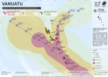
The compound cyclone events of Tropical Cyclones Judy and Kevin in 2023 showed how back-to-back storms can overwhelm island systems, damage food gardens, disrupt rural livelihoods, and increase recovery needs. FAO reported that both cyclones were Category 4 systems that affected food security and rural livelihoods in Vanuatu.
Cyclone vulnerability is especially high where houses are built with weak materials, roads are exposed to coastal erosion or landslides, communities rely on subsistence crops, and outer islands have limited emergency supplies, communications, and evacuation infrastructure.
4. Earthquake, tsunami, and volcanic vulnerability
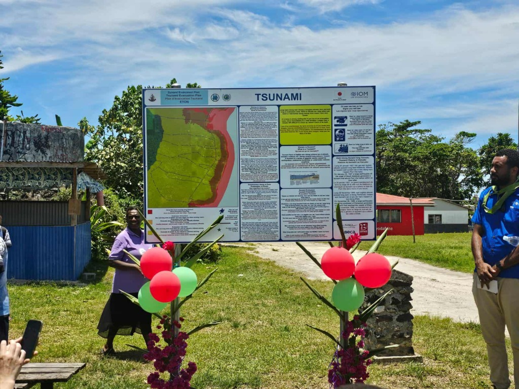
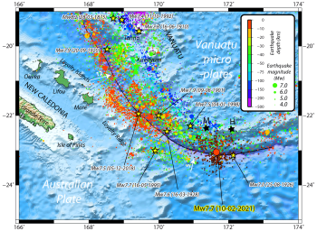
Vanuatu lies in a highly active tectonic and volcanic zone, making earthquakes, tsunamis, and volcanic eruptions central to its risk profile. The December 2024 earthquake demonstrated this exposure: Reuters reported that a magnitude 7.4 earthquake killed at least 14 people, injured more than 200, caused landslides and highway blockages, damaged buildings and infrastructure in Port Vila, and led to a state of emergency. (Reuters)
Earthquake risk is especially serious because it can trigger cascading impacts: building collapse, landslides, road failure, water-supply disruption, port disruption, school and hospital damage, and tsunami risk. Volcanic hazards can also affect communities through ashfall, gas emissions, lahars, crop damage, water contamination, evacuation needs, and long-term displacement.
5. Coastal vulnerability, sea-level rise, and saltwater intrusion
Coastal risk is one of Vanuatu’s most strategic vulnerabilities. Many settlements, roads, schools, health centres, churches, markets, ports, gardens, burial sites, and cultural assets are located close to the sea. Sea-level rise, storm surge, coastal erosion, wave overtopping, and saltwater intrusion can damage infrastructure, contaminate freshwater lenses, reduce agricultural land, degrade ecosystems, and force difficult relocation decisions.
The Vanuatu Coastal Adaptation Project focused on building resilience through improved infrastructure, sustained livelihoods, and increased food production in vulnerable coastal zones. (adaptation-undp.org) This reflects a core adaptation need: coastal protection must combine engineering, ecosystem restoration, land-use planning, livelihood support, and locally led relocation where risk becomes unacceptable.
6. Flood, landslide, and water-security vulnerability
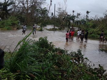
Extreme rainfall can rapidly trigger flash floods, landslides, river overflow, debris flows, and drainage failure, especially on steep volcanic islands and degraded slopes. Floods and landslides can damage roads, bridges, water systems, schools, clinics, houses, food gardens, and communications, while also isolating communities and delaying emergency response.
Freshwater security is highly climate-sensitive. Many communities rely on rainwater harvesting, springs, wells, small streams, groundwater lenses, and local storage systems. Drought can reduce water availability, while cyclones and floods can contaminate supplies with saltwater, debris, pathogens, and sediment. Water-system resilience is therefore central to health, food security, education, and disaster recovery.
7. Agriculture, fisheries, and livelihood vulnerability
Agriculture and fisheries are central to Vanuatu’s food security, culture, income, and rural resilience. Subsistence and smallholder agriculture are vulnerable to cyclones, drought, floods, saltwater intrusion, pests, plant disease, soil erosion, and changing rainfall patterns. Fisheries are exposed to coral reef degradation, ocean warming, acidification, storm damage, sedimentation, and unsafe sea conditions.
| Sub-sector | Main climate and hazard risks |
|---|---|
| Food gardens and root crops | Cyclone wind damage, flooding, drought, saltwater intrusion, pests, soil erosion |
| Cash crops | Cyclone damage, rainfall variability, transport disruption, market-access losses |
| Livestock | Heat stress, water shortages, cyclone damage, feed scarcity, disease |
| Coastal fisheries | Coral reef decline, storm damage, marine warming, rough seas, reduced fish habitat |
| Tourism livelihoods | Beach erosion, coral bleaching, cyclone damage, infrastructure disruption |
| Outer-island livelihoods | Transport isolation, water stress, limited recovery finance, weak market access |
Climate adaptation for Vanuatu therefore needs to protect both productive livelihoods and subsistence systems, including resilient crops, seed banks, agroforestry, reef conservation, safe boat access, fisheries management, and climate-informed livelihood diversification.
8. Health and social vulnerability
Climate change can increase health risks through heat stress, diarrhoeal disease, waterborne disease, vector-borne disease, malnutrition, injury during cyclones and earthquakes, mental stress, trauma, and disruption of health services. Floods and cyclones can damage WASH systems, contaminate water supplies, destroy food gardens, and increase disease risks after disasters.
The most vulnerable groups include outer-island communities, coastal households, subsistence farmers, fishing communities, women-headed households, children, older persons, people with disabilities, informal urban residents, people living near unstable slopes or flood-prone areas, and communities exposed to volcanic, tsunami, or coastal erosion risks. Vulnerability is highest where hazard exposure overlaps with weak housing, poor water storage, limited savings, long transport distances, limited insurance, and delayed access to emergency services.
9. Sector-specific vulnerability summary
| Sector | Main climate and multi-hazard risks |
|---|---|
| Coastal settlements | Sea-level rise, storm surge, coastal erosion, saltwater intrusion, tsunami exposure |
| Agriculture and food security | Cyclones, drought, floods, pests, saltwater intrusion, crop losses |
| Fisheries and marine ecosystems | Coral bleaching, ocean warming, acidification, storm damage, reef degradation |
| Water and WASH | Drought, rainwater shortage, flood contamination, saltwater intrusion, damaged systems |
| Transport and infrastructure | Cyclone damage, coastal road erosion, landslides, bridge damage, port disruption |
| Health | Waterborne disease, malnutrition, heat stress, disaster injuries, trauma, service disruption |
| Education and public services | School damage, evacuation disruption, communication failure, prolonged recovery |
| Geophysical risk | Earthquakes, tsunamis, volcanic eruptions, landslides, evacuation and relocation needs |
| Tourism | Beach loss, reef degradation, cyclone disruption, water stress, infrastructure damage |
10. Priority resilience needs
Vanuatu’s resilience agenda should prioritize multi-hazard early warning systems, impact-based forecasting, cyclone preparedness, coastal inundation warning, tsunami and earthquake preparedness, volcanic monitoring, climate-resilient water systems, resilient agriculture, fisheries and reef resilience, cyclone-safe infrastructure, disaster risk financing, and locally led island adaptation. The Green Climate Fund’s 2024 NAP readiness support for Vanuatu emphasizes strengthening technical skills, frameworks, systems, and finance to design and implement gender-sensitive and socially inclusive adaptation actions across key sectors. (Green Climate Fund)
| Priority area | Key actions |
|---|---|
| Early warning and anticipatory action | Impact-based warnings for cyclones, floods, landslides, storm surge, drought, tsunamis, earthquakes, and volcanic hazards |
| Cyclone and coastal resilience | Cyclone shelters, resilient housing, coastal-risk mapping, nature-based protection, safe evacuation routes |
| Water security | Rainwater harvesting, protected springs, drought planning, salinity monitoring, flood-safe WASH systems |
| Climate-resilient agriculture | Cyclone-resilient crops, seed banks, agroforestry, soil conservation, pest monitoring, food storage |
| Fisheries and reef resilience | Coral reef protection, marine protected areas, sustainable fisheries, safe harbours, livelihood diversification |
| Geophysical preparedness | Earthquake-safe construction, tsunami evacuation planning, volcanic monitoring, drills and public alerts |
| Infrastructure resilience | Climate- and seismic-resilient roads, bridges, ports, schools, clinics, power and communication systems |
| Risk financing and recovery | Contingency finance, insurance, forecast-based financing, resilient reconstruction, local recovery funds |
The National Disaster Management Office (NDMO)
The National Disaster Management Office (NDMO) is a government department under the Ministry of Climate Change and Adaptation. It is the government’s agency responsible for coordination of responses to emergencies and disasters across Vanuatu.
Our vision is to ensure that there are resilient communities throughout Vanuatu by integrating the coordination of Disaster Risk Management and Climate change Adaptation into sectoral plans, policies and budgeting. NDMO works to achieve its vision by being ‘The National emergency and disaster coordination agency to improve its coordination mechanism and building strong capability through establishment of solid partnership with other line emergency responders in country to continue to save life and property of all citizens’.
NDMO wants to achieve this vision through effective coordination of responses to emergencies and disaster; strengthening disaster and climate change network at National, Provincial and community level; mainstreaming DRR and CCA programs and activities into other sector plans, policy and budget; inform community and partners at all layers on hazards and risks for safer development planning program; improve effective and reliable communication networks and linkages amongst all partners at the national, provincial and at community level; and facilitate capacity building on DRM and CCA at all levels.
NDMO focuses its work into disaster preparedness and response. The department works closely with local and international NGO helping communities to be disaster resilient in the development and strengthening of disaster risk reduction and disaster management plans, including mitigation, response, relief and recovery as a whole. We work with the private sector as well in terms of Telecommunications, transportation and hardware houses during emergencies. Our work expands to a collaboration with the Municipal council as well when talking about the people living in the municipal area.
Coordination Structures
The National Disaster Management Office is the government’s agency responsible for coordination of preparation and responses to emergencies and disasters across Vanuatu. For the lastest udpates on the work of the NDMO and our partners see the News section or click on one of the articles on the right.
Cyclone awareness
Vanuatu is regularly subject to Cyclones between November and April each year. Communities in Vanuatu have built up a strong resilience to natural hazards through generations of experience in managing them. The Ministry of Climate Change Adaptation through the National Disaster Management Office (NDMO) and the Vanuatu Meteorological and Geohazards Department (VMGD) support communities to prepare for and respond to Cyclones.
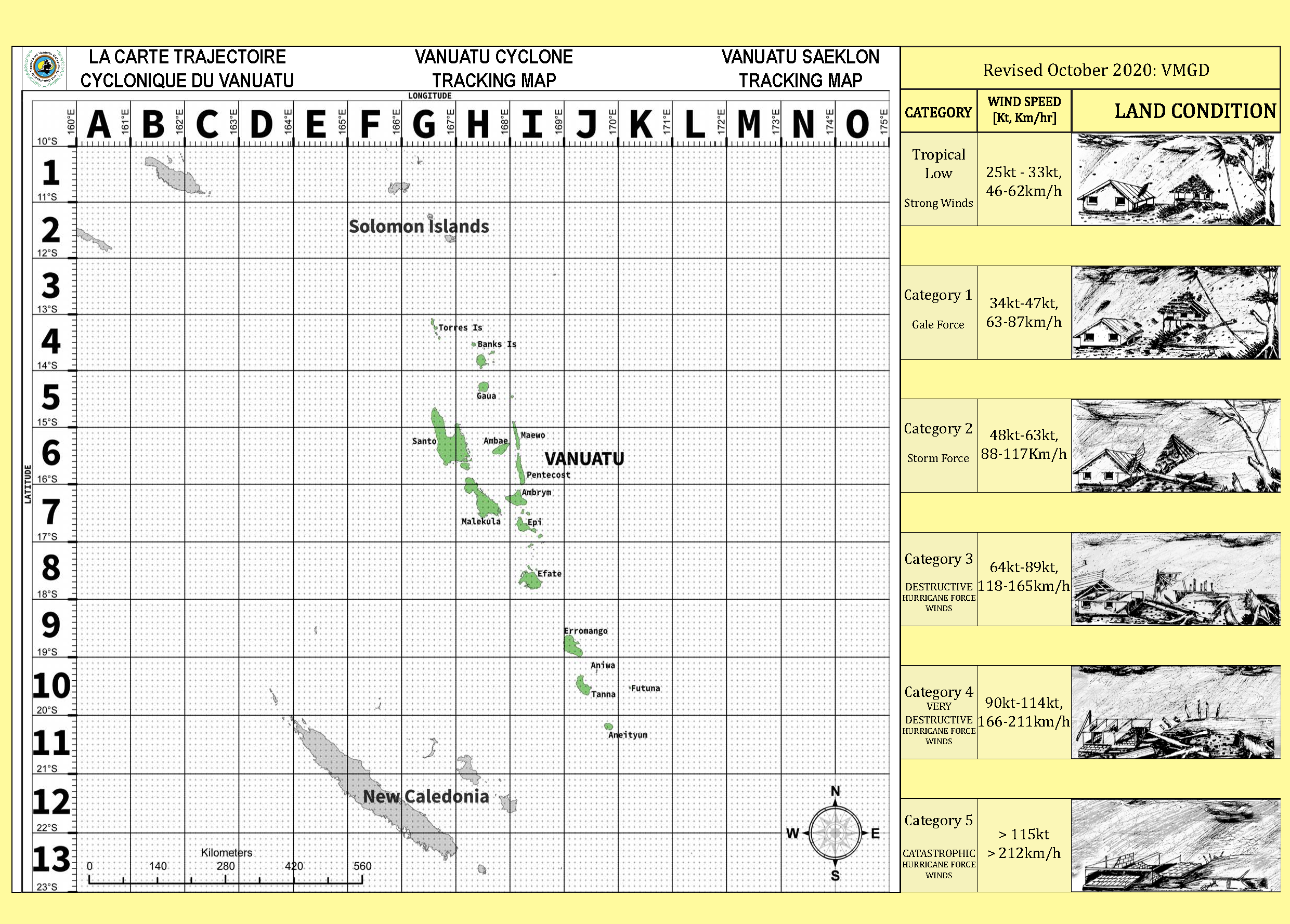
VMGD has advanced weather forecasting systems and publishes the Tropical Cyclone Warning each day of the cyclone season at 6am and 6pm. The Cyclone Tracking Map has been prepared for communities to keep up to date on the location of any cyclones in the region by following regular radio updates that describe the latest position of a cyclone on a grid that can easily be seen on the tracking map. Download and print a copy of the tracking map now and discuss it with your family, friends and community. It has lots of information about cyclones categories, the official alert system and radio stations that regularly broadcast advisory updates and warnings.
The NDMO has a Cyclone Support Plan that documents the roles and responsibilities for Government line ministries and partner agencies in preparing for and responding to a Cyclone, more information can be found here on the Cyclone Support Plan.
Colour alerts
Blue Alert
VMGD is forecasting a Cyclone within 48 hours – BE PREPARED
• Stay tuned and informed through Radio, TV, SMS, or Internet
• Secure and stow away loose material and rubbish, tie down roof, prepare and erect cyclone shutters
Yellow Alert
VMGD is forecasting a Cyclone within 36 hours – GET READY, ACT NOW
• Stay tuned and informed through Radio,TV, SMS, or Internet
• Bring together people you are responsible for, including bringing children back from school
Red Alert
VMGD is forecasting a Cyclone within 24 hours – STAY IN SHELTER OR SAFE PLACE
• Stay tuned and informed through Radio, TV, SMS, or Internet
• Turn off all gas and electricity and unplug all electrical items from the sockets
Cyclone categories
| Land Impact | Sea State | |||
| Tropical Low | 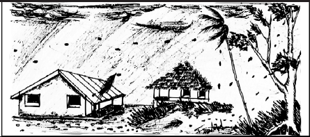 | 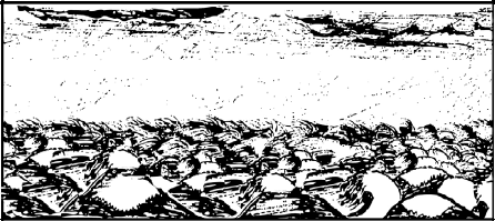 | ||
| Category 1 |  | 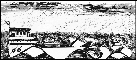 | ||
| Category 2 |  | 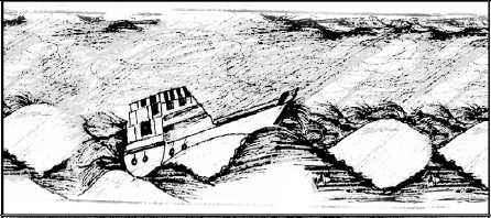 | ||
| Category 3 | 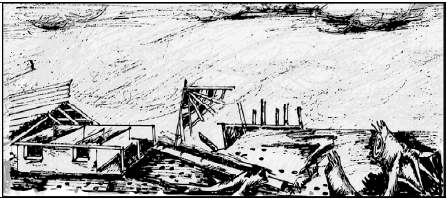 |  | ||
| Catgeory 4 |  |  | ||
| Category 5 | 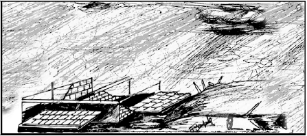 | 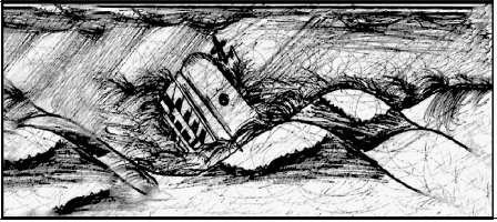 |
Featured
Vanuatu Cyclone Tracking Map
Listen to the radio and check SMS for Tropical Cyclone location coordinates to track Tropical Cyclone location on Tracking Map.
Radio Broadcast Frequencies
Listen to the radio and check SMS for Tropical Cyclone location coordinates to track Tropical Cyclone location on Tracking Map.